Category Archives: Stream Clean-ups

Posts related to stream clean-ups

Get to know some local chelicerates, from spiders to scorpions and pseudoscorpions

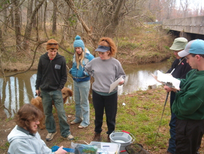
This is an excerpt from my article in the September – October issue of Triangle Gardener magazine, available at local libraries, the NC Botanical Garden, plant nurseries, etc. and posted online at www.trianglegardener.com. This is the last part of the article. Also, the annual Big Sweep and UNC University Day trash clean-ups are coming up in October. Late September also seems to be the season when copperheads get on roads at night, often in the same places every year, and then can’t or won’t avoid traffic, possibly because they get too cold, and get killed. I carry a metal grabber so I can safely remove copperheads, but I often come across them too late. Note that people have been ‘bitten’ handling dead snakes.

I doubt that arachnophobia is innate, but I have long been disturbed by spiders. I used to be a bit creeped out just looking at the photos in the Audubon guide to insects and arachnids. When I was very young there were large, striped spiders in my backyard, perhaps rabid or dotted wolf spiders, and unfortunately I tried to kill them. I don’t remember going out of my way to knock down webs and some arachnids and spiders were less unsettling. I wasn’t really afraid of omnivorous daddy longlegs, also known as harvestmen or shepherd spiders, though I think I was bitten once. NC has many species of daddy longlegs. Later I volunteered in UNC’s invertebrate biology lab, and was asked if I wanted to hold the hairy, palm-sized tarantula. It had its legs tucked in and didn’t move, so it wasn’t very trying. On the other hand last fall I was disturbed when a brown orbweaver, spinning its, probably her, web at the front door on a breezy evening suddenly dropped down to anchor a line, revealing just how large and ‘spidery’ she was, legs outstretched. A few weeks ago I saw a pretty large wolf spider indoors. I was preoccupied at the time, so I let it stay inside temporarily as a beneficial animal, but I haven’t seen it since.

Insects have three body sections and six legs with five parts, while spiders have two body sections and eight legs, with seven parts. Crustaceans are arthropods with 10 legs and four antennae, but are accepted as food animals. Insects generally have a pair of compound eyes and three smaller simple eyes, while spiders have at most eight simple eyes, the arrangement and acuity varying by family. Moving a pencil tip around a corner attracts a sharp-eyed jumping spider, like a curious cat. Jumping spiders might also tend to be more intelligent than most spiders, especially those that specialize in hunting other spiders. Spiders use ‘hairiness’ for functions like sensing, in the absence of antennae; defense; etc. Spider chelicerae end with sharp, venom-injecting fangs and are sometimes toothed. The chelicerae and pedipalps just behind rub together to grind up prey, but spiders typically only consume pre-digested juices. Some spiders are actually omnivorous or even mostly herbivorous. Males can be identified by their clubbed pedipalps, used in mating. Many spiders engage in courtship and in most species males survive the attempt. It seems like arachnids are often longer lived than insects and spiders often mature later in the growing season. Spiders can go to an exposed point, such as the roof of a car, and release a long silk thread to catch the wind and balloon to a new location. Spiders typically make several kinds of silk, even a silk just for egg sacs. Medicine spider silk was once used to make a painkiller and clothes, bandages, and canvases for painting have been made with spider silk.

The NC Biodiversity Project website lists 713 arachnids in the state. LL Gaddy estimated in 2009 that there are around 600 spider species in the Carolinas. The Tuscarora orbweaver is only found in NC, including in Durham County. The spruce-fir moss spider is an endangered species found on peaks in the Appalachians.

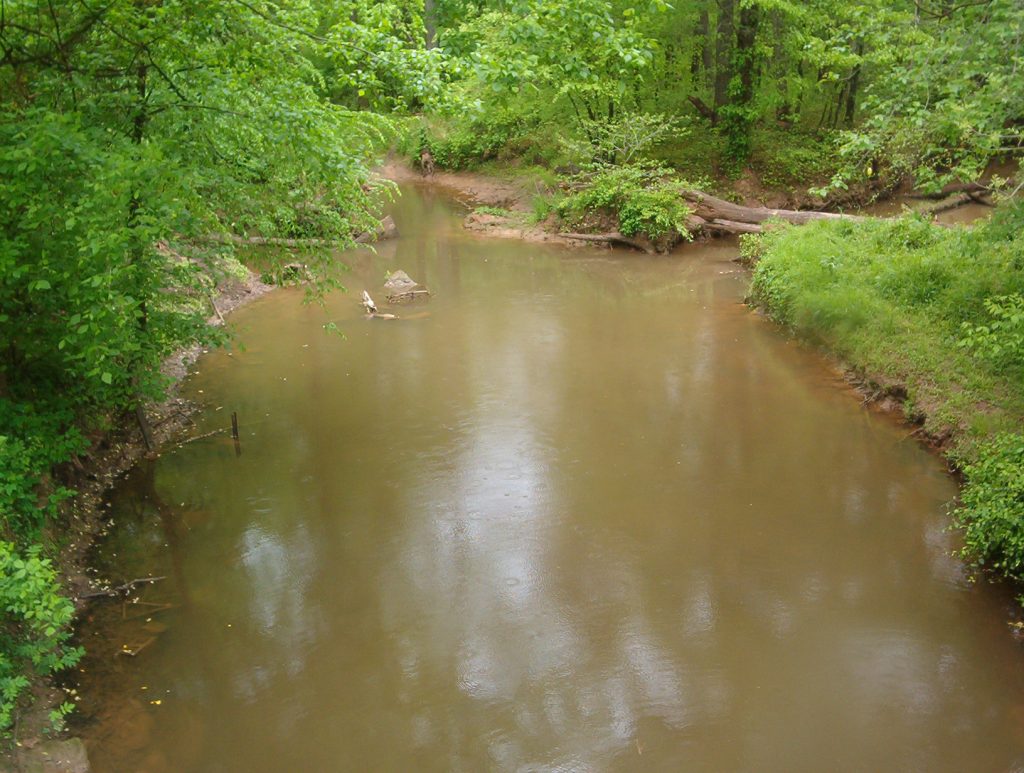
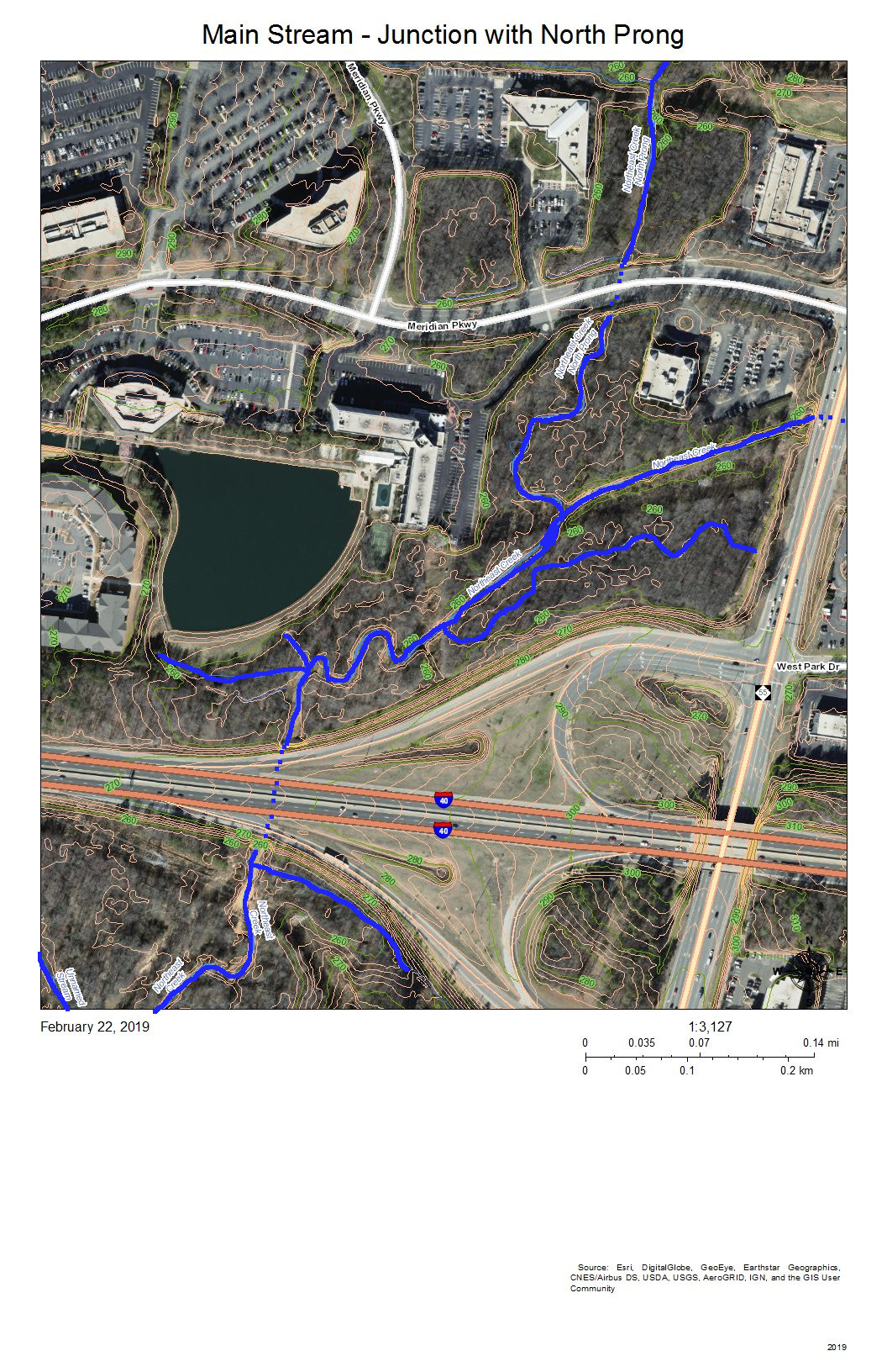
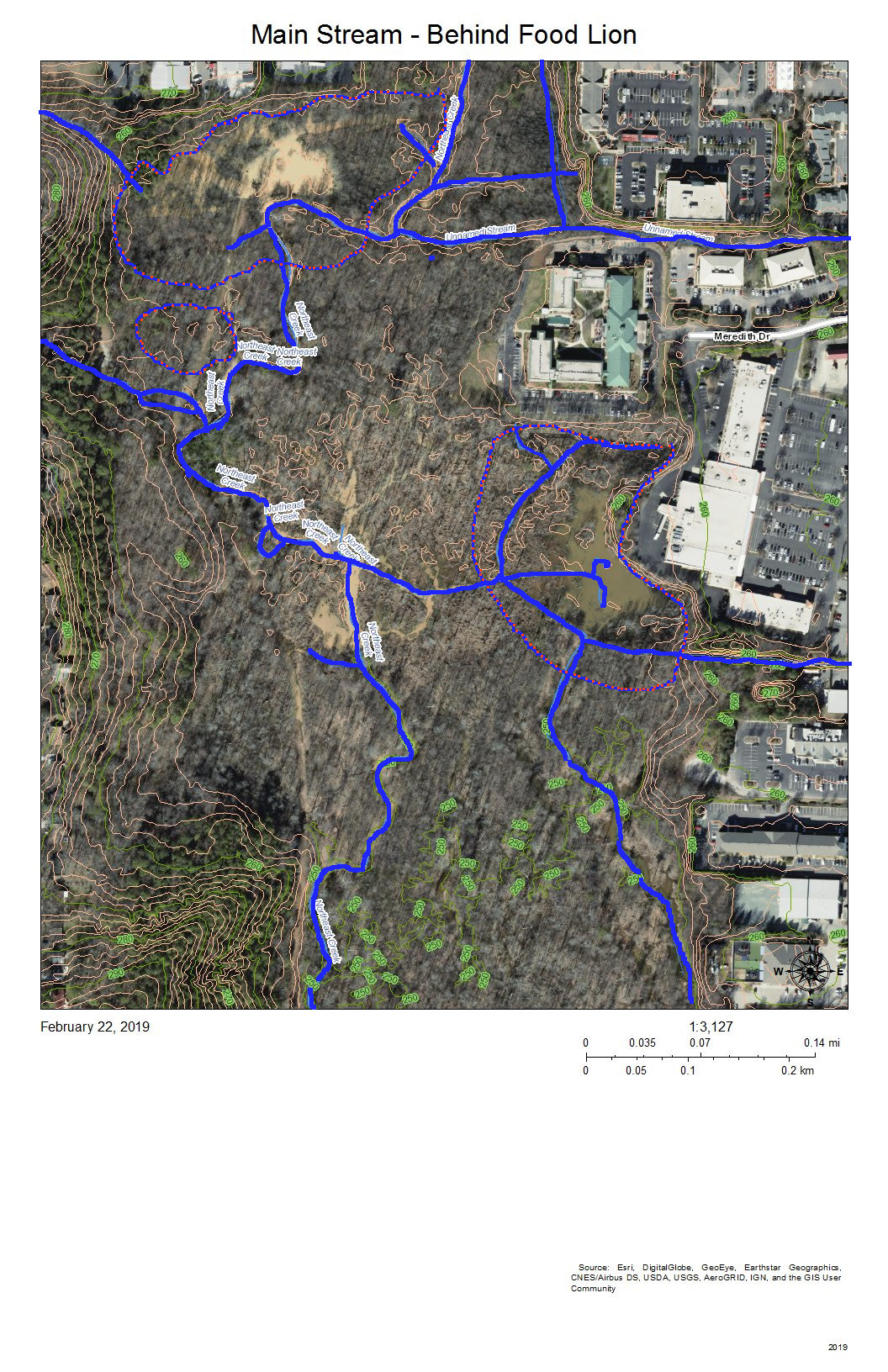
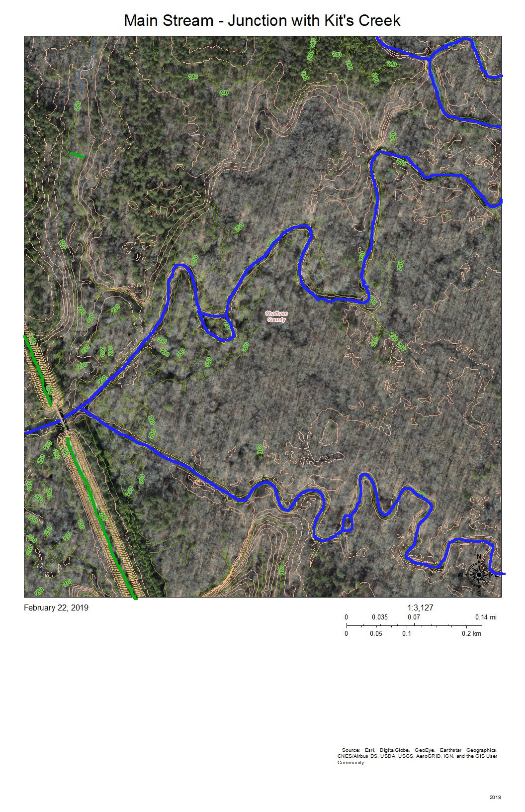
At Falls Lake State Recreation Area there are black trapdoor spiders of some kind, resembling tarantulas. Actual tarantulas are considered a normal food animal in some cultures. Huge dark fishing spiders live around the park buildings, where I saw one kill an adult Carolina mantis. Smaller and more aquatic six-spotted fishing spiders, which actually have more than six spots, might be seen around Parkwood’s Euclid Pond on summer days, delicately moving on and sometimes under the surface. Species of elongated long-jawed spiders typically build their webs in vegetation at the edges of ponds and are common in the area.

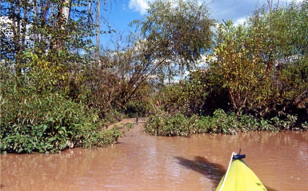
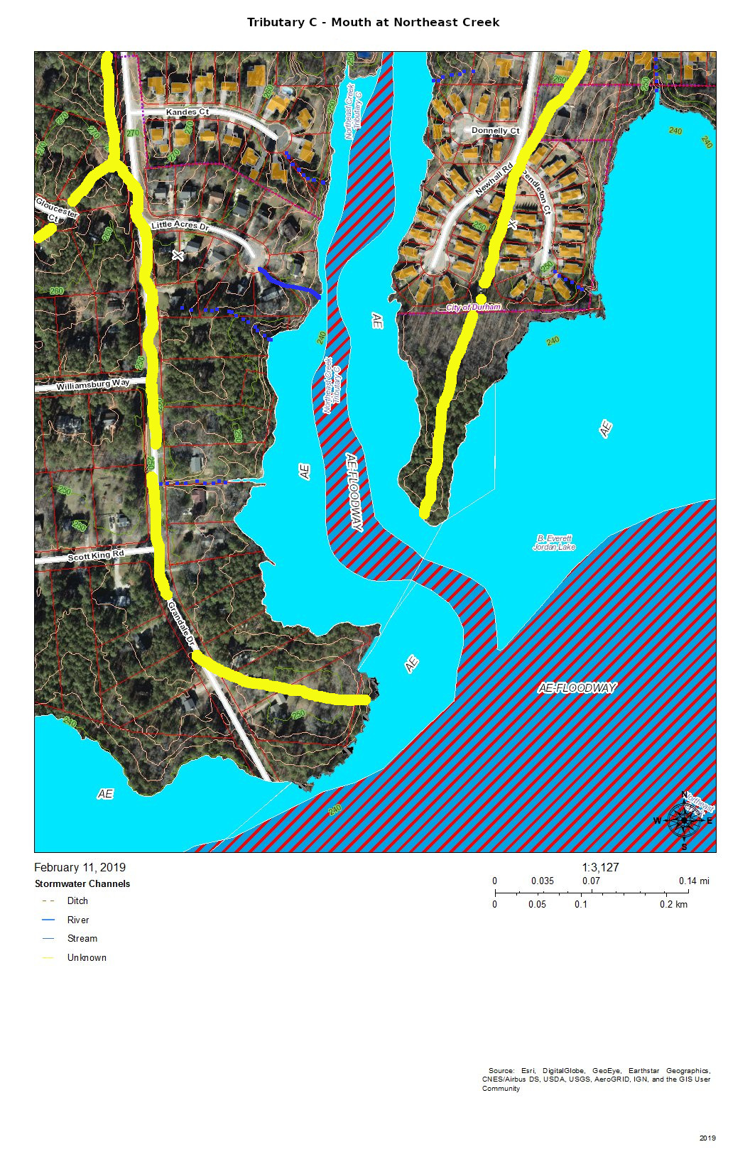
Once I got lost in a scrubby forest behind Kure Beach, between Wilmington and the end of the Cape Fear River, where the water from Northeast Creek meets the sea, and was struck by the many large brown and yellow butterflies, probably giant swallowtails, flitting about. I was also struck by the numerous boxy webs inhabited by very large female golden silk orbweavers and much smaller males. It seemed like the spiders weren’t catching the similarly huge swallowtails, but I have seen other orbweavers capture a swallowtail or cicada. Golden silk orbweaver build their webs in stages and refurbished them a half at a time. I think I read that they have been found in Raleigh, but these spiders might have been brought back by vacationers. On the other hand with a warming climate they might extend their range inland. Southeastern NC is at the northern limit of their range, which extends to the Amazon. Male spiders often live near or in webs spun by females, but truly social spiders are limited to the tropics. There is also the case of introduced snakes killing off native birds in the tropical Pacific, leading to forests abnormally full of solitary spider webs.

Another large orbweaver is the yellow garden spider, known for the stabilimentum, a jagged line down their webs. In recent years I had some, the males staying near the females. One morning last summer a wrapped up and stored away and May beetle was waving a backleg and I peeled off the silk and freed it , apparently unharmed, but afterward the female left, as if taking umbrage, followed by her retinue, and I haven’t seen any since.

There are still one or more large brown nocturnal orbweavers, maybe Neoscona species, though it seems like they were more abundant many years ago. I saw one or two near porchlights over the summer, but not in recent weeks. Occasionally the large orbweavers are joined by much smaller conical spiders colored like liquid mercury, species of Argyrodes, co-habiting the webs as kleptoparasites, feeding on caught insects and possibly also on the orbweavers when they die in the fall.

Several smaller orbweavers can be seen during the day in wooded areas and yards and their webs can stick to people in late summer. This summer I noticed a few spiny orbweavers, white or yellow with somewhat colorful spots and ‘spines,’ the harmless spikes possibly providing some protection from birds. Their webs have prominent white dashes around the edges and in the center. More familiar Micrathena orbweavers are also spiny. It seems like triangulate orbweavers or something similar like to place their large webs across bottomland clearings. Triangulate orbweavers have a prominent white, yellow, or pink triangle on the top of their abdomen. Conical trashline orbweavers leave a vertical line of silky debris in their webs.

I sometimes see widows in webs around house foundations and in outbuildings. Female Northern and Southern black widows are large and black with bright red markings, but the smaller males look different and brown widows are moving north. Unrelated brown recluses are apparently not native to the Carolinas and are rare. These are the only venomous spiders regularly found in the Carolinas whose bites might cause serious effects. Some spiders are physically unable to bite humans and in general venomous animals won’t bite or sting if left alone and if they do, some have the option of injecting little or no venom.

I occasionally see green lynx spiders, relatively large and bristly spiders that hunt on plants, females turning from bright green to brown in the the fall. Aparently green lynx spiders fill an ecological niche similar to that of crab spiders. I see various crab spider species more often, usually lying in a wait on an upper leaf or flower, where they can be very colorful for camouflage.

[11/21 edit – Spiders frequently turn up in religion and mythology and there are many ideas about spiders (usually small) bringing general luck, money, visitors, letters, or new clothes and prognosticating the weather. Sometimes small spiders were nonchalantly eaten alive for luck, etc. On the other hand it is considered unlucky to kill spiders (maybe this is only at night) and daddy longlegs (it’s possible that this actually refers to a spider often found indoors in Europe – see the Spiders of North-West Europe website linked below). This has also been said about killing crickets, katydids, ladybugs, wasps, toads, frogs, doves, etc. For some reason killing a spider was linked with water, while killing a toad was linked to fire. Taking down webs and cobwebs has also been said to be unlucky. Spiders have been used for illness such as fevers (ague), malaria, and whooping cough and their webs were supposed to staunch bleeding. Medicine spider webs were mentioned above.]


Some resources:


Spiders of the Carolinas LL Gaddy, 2009

The Audubon Guide to North American Insects & Spiders [and other arachnids] Lorus and Margery Milne, 1992

North Carolina Biodiversity Project – Arachnids – www.nc-biodiversity.com/taxonomic-group/arachnids

Arachnids of NC, from the above site – auth1.dpr.ncparks.gov/arachnid/index.php .

Arachnids of NC checklist – auth1.dpr.ncparks.gov/arachnid/checklist.php?format=pdf

Biology of the Invertebrates, Fourth Edition Jan A Pechenik, 2000

The Life of the Spider John Crompton, 1954 – anecdotes

eco.confex.com/eco/2008/techprogram/P12401.HTM – a mostly vegetarian Central American jumping spider – information at the 93rd annual meeting of the Ecological Society of America

A review of the ethology of jumping spiders (Araneae, Salticidae) David B Richman and Robert R Jackson, 1992 – www.peckhamia.com/hosted/Richman%20Jackson%201992%20A%20review%20of%20the%20ethology%20of%20jumping%20spiders.pdf

Pseudoscorpions of the World – museum.wa.gov.au/catalogues/pseudoscorpions

Spiders of North-West Europe – ednieuw.home.xs4all.nl/Spiders/spidhome.htm

World Spider Catalog – wsc.nmbe.ch/statistics/

Global Biodiversity Information Facility – www.gbif.org

BugGuide – www.bugguide.net/

American Arachnological Society – Americanarachnology.org

International Society of Arachnology – arachnology.org

The Arachnid Order Solifugae – www.solifugae.info/index.html

AracnoLab – Aracnologia MNRJ – Museu Nacional/Universidade Federal do Rio de Janeiro – mndi.museunacional.ufrj.br/aracnologia/ – on daddy longlegs, harvestmen, or shepherd spiders

Jumping spiders (Arachnida: Araneae: Salticidae) of the world –www.jumping-spiders.com

International Field Guides – find a field guide by subject or region – www.library.illinois.edu/biology/fieldguides/

[The Complete Illustrated Book of the Psychic Sciences, Walter B and Litzka R Gibson, drawings by Murray Keshner, 1966.

A Dictionary of Superstitions, Iona Opie and Moira Tatem, 1989.]

What a Wild 16 Years It Has Been

march 2006 stream monitoring - grandale road
2006: New members of Northeast Creek Streamwatch watching Michael Pollock demonstrate the procedure for monitoring streams.

In 2005, Michael Pollock set up a table at the Parkwood October Flea Market and signed up volunteers to monitor Northeast Creek at Grandale Road and at Sedwick Road as part of a North Carolina effort to improve water quality and introduce the public to the notion of “non-point” sources of pollution: runoff from over-fertilized lawns, dog poop, litter, and the dumping of objects and litter into “unused land” including stream basins. After 16 years, we are very clear now that there is no “away” to throwing it away; pollutants stay somewhere.

a map of the northeast creek streams
A 2006 map of the location of the streams that constitute the Northeast Creek watershed.

Through a “Where Is Northeast Creek?” publicity campaign with tabling, cards, and tee shirts, we became aware of the major tributaries of Northeast Creek and the relationship of the streams to roads and neighborhoods. The “four corners” of the watershed in Durham County are Emorywood (NW), Bethesda (NE), Research Triangle Park (SE), and C. J. Herndon Park (SW). The bottom corners in Chatham and Wake counties are the mouth of Northeast Creek at the NC 751 bridge over Lake Jordan (SW) and Green Hope High School in Cary (SE). In the map above the railroad track symbol that runs from the “h” in “Northeast” up to the Chatham/Durham line is the railroad that is now the American Tobacco Trail.

source of northeast creek near eastern connector
Source stream running down a steep slope viewed from the bridge on Glover Road that crosses the Durham Freeway (NC 147)

It did not take long to explore the sources of Northeast Creek, in Emorywood, Bilboa, Bethesda, Research Triangle Park, Morrisville, and Green Level.

Northeast Creek is a Triassic Basin stream that descends from the ridge between the Cape Fear River basin (Lake Jordan) and the Neuse River basin (Falls Lake). The steep slopes near downtown Durham and the North Carolina Railroad give way to wet bottom lands near the Ellis-SoHi intersection and in Meridian Park. South of I-40, the wetland alternates between braided streams and meanders with ox-bow pools. By the time it flows into Lake Jordan, it has gathered the runoff from 47 square miles of watershed. It is typical of a stream in the fall zone of the Carolina Piedmont.

kayak at mouth of northeast creek
Mouth of Northeast Creek as seem from a kayak in Lake Jordan

Eventually, one who lives in the Northeast Creek basin will want to see where it empties into Lake Jordan. In the 2007 drought, it was possible to walk around the lake shore to the mouth. Most often, a kayak is a more convenient form of transportation. After rainstorms, one will notice the suspended colloidal clay from the rapid runoff over bare ground that gets retained all the way to the mouth of Northeast Creek.

Water determines how land is developed. How land is developed determines the quality of water.

In 2005, Michael Pollock adopted Northeast Creek as a North Carolina Division of Water Quality Stream Watch project and coordinated with Laura Webb Smith, City of Durham’s environmental educator on adopting a part of Northeast Creek in Durham. Christine Todd Whitman, the EPA Administrator had promoted and adopt-your-stream program in 2005 that became North Carolina’s Stream Watch program. In 2007, Randal Haithcock adopted the entire Northeast Creek watershed under the EPA Adopt-a-Stream program.

canoe as float - Parkwood Christmas Parade 2006
Kids from the Parkwood Library craft program riding in a canoe as a Northeast Creek Streamwatch unit of the Parkwood Christmas parade 2006

By December of 2006, it was clear that people would have to love Northeast Creek to protect and be aware of its existence if they were to learn to love it. Something about a sense of place was emerging. Northeast Creek Streamwatch enlisted volunteers from the Parkwood Library (before South Regional Library was constructed) to create costumes and ride a float in the Parkwood Christmas Parade on behalf of Northeast Creek Streamwatch.

christmas 2006 float before the parade
Some of the Northeast Creek Streamwatch unit before the parade. Susanne Gomolski is second from right.

A Chapel Hill resident who was supporting Northeast Creek Streamwatch and operating Kayak Adventures, the late Susanne Gomolski offered to provide the equipment for the float, a canoe and kayaks, that she used to take tours of the mouth of Northeast Creek and other places around Lake Jordan.

lake jordan kayak outing for christmas parade crew
Lake Jordan kayak outing for 2006 Christmas Parade crew

In the late spring of the next year, the volunteers who were in the Christmas Parade camped out at Lake Jordan and paddled kayaks in one of the arms of the lake. One of the thrills was seeing a bald eagle taking a fish from the waters of Lake Jordan.

I B M environmental day 2007
Northeast Creek Streamwatch provided a tent a the IBM Environmental Day for several years in a row; this is from 2007.

During Earth Week, volunteers from Northeast Creek Streamwatch tabled at the annual IBM Environmental Day, raising awareness about the effects of polluted water on amphibians.

Earth Day 2006 Clean-up - Grandale Road Bridge
The results of the Earth Day 2006 clean-up at Grandale Road bridge. Note the motorcycle.

The previous Earth Day, the first major clean-up at the Grandale Road bridge netted this load of trash, including a motorcycle.

Earth Day 2006 after clean-up
Northeast Creek after the Earth Day clean-up

After the 2006 cleanup the creek at Grandale Road had lost a lot of trash.

one of the clean-up teams on earth day 2007
One of the clean-up teams on Earth Day 2007

In 2007 Northeast Creek Streamwatch had a larger clean-up with over 30 people and teams cleaning up four locations; this is one of the teams.

northeast creek bottom lands map

The natural heritage inventory study area for the Northeast Creek Bottomlands in Durham County NC

Advocacy began in 2006 with efforts to ensure an adequate upland buffer around the Northeast Creek Bottomlands, a Durham County designated significant natural area of plants and wildlife.

The cover of the inventory that designated all of the important natural areas in Durham County:

Cover of the Durham County Inventory of Important Natural Areas, Plants, and Wildlife, 1999

Our first glimpse of the property that applying to be a high-density single-family residential development looked like this view from Corps of Engineers property.

scott king property first view
Picture of Scott King Road property (now Lyon’s Farm Elementary School) taken from Corps of Engineers property March 2006

After two years of advocacy, the neighborhoods and Northeast Creek Streamwatch, the zoning proposal was withdrawn and the property purchased by Durham Public Schools as what is now Lyon’s Farm Elementary School.

bee james farmhouse 2010
The appearance of the Bee James farmhouse when Durham Public Schools acquired the property in 2010.

In 2010, Durham Public Schools allowed Northeast Creek Streamwatch a site visit. We photographed the farmhouse, native plants, and the area between the DPS site and the American Tobacco Trail bridge. This view of the farmhouse shows that it had an enclosed front porch and a tin roof. We are still researching the history of occupation of this farmhouse, but it might have been vacant as long as 48 years by this point.

dressed red sandstone boulder in foundation of Bee James farmhouse
This red sandstone foundation block is what inspired the archaeological salvage effort at the construction site of Lyon’s Farm Elementary School.

In 2015, Durham Public Schools contacted us, saying that they were beginning the design phase of school construction and had their capital and construction manager meet us to walk the site. When we did this, we found that a brush fire had burned the house and blackened some of the pine trees. In the ruins of the foundation and the cold cellar, we saw this dressed red sandstone block and decided that we needed to find out more about this house’s history.

farmhouse foundations and chimney after cleaning
Farmhouse foundations and chimney after cleaning brush away and clearing brush out of the cold cellar

On Martin Luther King Day 2016, Northeast Creek Streamwatch volunteers cleaned the brush away from the foundations and took a picture of the exposed chimney and the cold cellar. We also contacted the NC State Archaeologist’s Office to provide a framework for any documentation or salvage archaeology. The story of this place was worth telling to the students who would attend the school; it would give them an up-close view of what history and archaeology are.

stone wall at southeast corner of Bee James house, Lyon's Farm Elementary School site
Archaeological documentation of SE corner of Bee James farm house foundations at Lyon’s Farm Elementary School site

Preliminary research showed that the property was acquired in 1942 by a black farmer named Bee James; property that Durham Public Schools also acquired for this project was owned by Eddie Lyon; another tracts had be owned in the 1950s by the Pritchards.

north wall of farmhouse foundation marked for reconstruction
North wall of farmhouse foundation marked for reconstruction

During the documentation of the old farmstead, the north wall of the cold cellar was marked to permit the option of reconstructing it. In this picture, you can see that the floor in the cold cellar was a tarpaper-coated floor boarding laid top of the first two courses of stone.

map of natural heritage inventory area behind lyon's farm elementary school
Continuous portion of the Northeast Creek bottom lands natural heritage area between Grandale Road and the American Tobacco Trail

Continuous portion of the Northeast Creek bottom lands natural heritage area in the meanders between Grandale Road and a section of the American Tobacco Trail. Coming in from the southeast of the American Tobacco Trail bridge is Kit Creek (Kitt Creek).

From 2015 onward, Northeast Creek Streamwatch has partnered with the biotechnology career program at Lowe’s Grove Middle School. Two years (before COVID-19) we celebrated Creek Week at Lowe’s Grove Middle School. We also partnered with the biotechnology career program and the NC Museum of Natural Science one year in a Dragonfly Detective citizen science program.

In 2015, Cory Quammen conducted a Save the Rain workshop to showcase the work that he and Durham Soil and Water did to control the runoff from his yard. He began instructing how to make hand-made rainbarrels from recycled pickle barrels.

In 2016, the Durham Soil and Water Conservation District named Northeast Creek Streamwatch as Urban Conservationist of the Year.

opening celebration of parkwood village wiggly trail July 2017
First procession down the newly opened Wiggly Trail at Parkwood Village, constructed by residents and neighbors with Neighborhood Improvement grant funds.

In 2017, Northeast Creek Streamwatch partnered with the Parkwood Village Association (PVA) in a City of Durham Neighborhood Improvement Program grant to reduce erosion going into Parkwood Creek (Tributary C) through construction of the Wiggly Trail and a garden of evapotranspirators next to the Parkwood Village swimming pool. The completion of the project was celebrated with a march down the new trail, with all of the participants from Parkwood Village, Parkwood, and other neighborhoods joining in the festivities.

painting pictures for the Wiggly Trail project
Volunteers getting art instruction in painting pictures for the Wiggly Trail Project in 2017

In 2017, the completion of the Wiggly Trail had a workshop for making rainbarrels and a workshop to paint pictures of native plants and butterflies

caterpillar at monarch festival 2018
Caterpillar created by Fayetteville Street Elementary School art students at Monarch Festival 2018

In 2018, Northeast Creek Streamwatch was one of the participants at the Monarch Festival at Sandy Creek Park. The art class at Fayetteville Street Elementary School brought a paper mache caterpillar made by students.

Cory Quammen showed a handmade water barrel and promoted the Upstream Neighbors-Downstream Neighbors program.

cory quammen promoting save-the-rain rainbarrel workshop
Cory Quammen promoting Save-the-Rain rainbarrel-making workshop at the Monarch Festival

Northeast Creek in the Corps of Engineers land is a different world of plants and animals, but still shows the issues of water quality that motivates continued work.

tree on north streambank of northeast creek near American Tobacco Trail bridge
Stream quality in March 2006 and showing stream bank erosion around tree roots.

At mouth of Northeast Creek is a multi-species bird rookery that includes this blue heron photographed by Susanne Gomolski.

blue heron - photo by susanne gomolski
A great blue heron in the rookery at the mouth of Northeast Creek

Tributary C of Northeast Creek: Where does your water go?

Creek Week is coming March 13 through 20. During that week Durham is focusing attention on how individual citizens and property owners can with modest efforts deliver significant benefits to the quality of water moving downstream, especially to Jordan Lake.

A fun activity during Creek Week is to find the path that water from your roof, sidewalk, driveway, and patio or deck takes as it goes to Northeast Creek, down Northeast Creek and into Jordan Lake, and down the Cape Fear River to Wilmington.

To do that, we must perceive streams and their tributary flows of runoff (the water) in the foreground and land in the background. Focusing on the flash flood zones at full flood (the flood zones identified on the maps) shows the land as necks extending into the fully flooded lake headwaters. After all, one of the primary purposes of Lake Jordan was mitigation of the flash flooding that often occurred in the Haw River and New Hope Creek basins.

The coloring of the flood zones represent the following:

  • Solid blue: 1% annual chance flood hazard
  • Blue with red diagonal stripes: Regulatory floodway
  • Gold: 0.2% annual chance flood hazard
  • Black with gray diagonal stripes: Future conditions 1% annual chance flood hazard.

A previous post showed that Parkwood comprises parts of three sub-basins:

  • The main stream of Northeast Creek on the east;
  • Tributary C feeding Parkwood Lake in the center;
  • Tributary D draining the western part of the McCormick high land and streams from Hunters Woods joining and running down Wineberry to the west.

This post presents maps to help find the path that the water takes from the roof of a particular house to Tributary C of Northeast Creek, which feeds the Parkwood Lake.  Future posts will look at Tributary D and the main stream of Northeast Creek.

Skim through the maps to the part of Tributary C that you want to examine and then click on the map to enlarge.  To enlarge further use the + keys in your viewer or Ctrl-+ on the keyboard.  There will be some street references in the text following each map.

Yellow lines mark the sub-basins of Tributary C.  Blue lines are the creeks in the area in the map title.  Dotted blue lines are intermittent creeks inferred from the topography or known significant stormwater pipes.  The impervious surfaces of roofs are orange, and the impervious surfaces of parking lots, driveways, and other concrete structures are gray.

Looking from the mouth of Tributary C and Northeast Creek, the sequence of maps examines each upstream branch and the main stream of Tributary C back to its source near NC 54.

A map of the mouth of tributary C at Northeast Creek with flood zones marked
Mouth of Tributary C at Northeast Creek

The mouth of Tributary C is a wetland flood plain that cycles between swamp forest in drier times and then snags (dead trees that are habitat for wildlife) and freshwater marsh in wetter times.  You can see this same sort of landscape on the north side of NC 54 by Woodcroft Shopping Center.

Runoff from the roofs and drives flows through the yards or down the streets to the cul-de-sacs and down slopes into the bottomlands.

A map of Tributary C south of the Parkwood Lake dam
Tributary C South of the Parkwood Lake Dam

The main stream south of Parkwood Lake comes down the spillways from the lake through woods, under Sedwick Road, and into the bottomlands. An intermittent stream drains the runoff from the houses on Dedmon Court, Donnelly Court, Newhall Road, and Sedwick Road.  An intermittent stream on the west side of the bottomlands drains the runoff from two houses on Sedwick Road and one on Grandale Road.

A map of the west side headwaters of Tributary C at Parkwood Lake
Tributary C as Parkwood Lake and the West Side Headwaters

The runoff from the houses on the west side of Parkwood Lake primarily flows down the streets, across Pelham Road and into the lake. The runoff from the houses on lake flows directly into the lake.

The runoff from the east side of Grandale Road just north of Sedwick Road is directed into the ditch on the north side of Sedwick Road and is a part of this section of Tributary C.

A map of the development east of Parkwood Lake that drains into the lake.
Tributary C – East Side of Parkwood Lake

The east side of Parkwood Lake drains the west side of Revere Road and Larkspur Circle in addition to the houses along Newhall Road and the lakefront houses. There seem to be two more-or-less permanent streams draining from either corner of Larkspur Circle.  There is significant Parkwood common land in the center of this block that aids in soaking up rainfall from Larkspur Circle and Revere Road.  Another stream drains Temple Lane and Buttonwood Court.

A map of the west fork of Tributary C and the development that is in its headwaters
Tributary C West Fork Headwaters

The west fork headwaters drain part of The Ridges of Parkwood, part of Parkwood Village, and some of the houses on Wenonah Way,  Runoff from the west fork headwaters flow directly into the Parkwood Lake forebay (former lotus pond).

A map of the headwaters of the two middle forks of Tributary C and the development in it
Tributary C – Middle Forks Headwaters

The headwaters of the two middle forks of Tributary C drain the southeast side of the McCormick Road highland.  The southernmost of the two middle forks drains most of Parkwood Village.

A map of the flood zones and development of the section of the main stream of Tributary C north of the forebay. that is, the former lotus pond of Parkwood Lak
Tributary C – Main Stream to Lake Forebay (former Lotus Pond)

This section of Tributary C shows the main stream in the area of the trail from the Parkwood ballfield to the Parkwood Lake forebay (former lotus pond).  The lower section is a significant bottomland that has a variety of interesting native plants such as magnolia, red maple, and native honeysuckle with hearts-a-bustin’, pussytoes, wild oregano, and lyre-leaf sage in the uplands.

A map of the drainage of Tributary C from east of Revere Road. Major sections of the drainage move through stormwater pipes that go under the parking lot of the former shopping center (now the Jamaat Ibad Ar-Rahman mosque) and empty into Tributary C through a single outfall
Tributary C – Drainage from East of Revere Road

The area of Tributary C east of Revere Road mostly drains through stormwater pipes the run under the parking lot of Jamaat Ibad Ar-Rahman mosque (former Parkwood Shopping Center).  The stormwater pipes converge and empty through a single pipe outlet to Tributary C opposite Parkwood Village’s road to its swimming pool (the Pool in the Woods).  This area drains from the hill on Brentwood Road near Bradley Circle and an area north of Brentwood Road almost to Travis Circle.  It also drains the slope behind Parkwood United Methodist Church and the apartments up to the parcel that was set aside in the original design for a water tower and conveyed in that designation to the Parkwood Association.  (In 1961, there were no city water and sewer services this far out.  The Parkwood subdivision had a private utility that provided water from wells and owned and operated the package sewage plants.)

This elaborate stormwater system is the legacy of the philosophy of controlling stormwater that was prevalent at the beginning of the 1960s — pipe it away.  The site preparation for “Parkwood Center”, the commercial and institutional core of the community froze some of the original stream system into the landscape while concentrating the flow under parking lots into a single stream.  The object was to dump the excess water as fast as possible into Tributary C.  After almost sixty years we can see that that strategy leads to stream scour and transportation of soil down the creek system.  And creates erosional undercutting of the stream bank opposite the single stormwater pipe outlet.

A map of the headwaters of the main stream of Tributary C showing flood zones, development, and a retention pond for a town home complex
Tributary C – Headwaters of Main Stream

The headwaters of Tributary C lie completely south of NC 54 because NC 54 was built on a ridge between two tributaries of Northeast Creek and because subsequent engineering of the highway has sharpened the separations of the drainage.  The headwaters now are developed as the Meadows at Southpoint, a town home community that uses regulation-permitted retention ponds instead of open space to manage run-off from its newly constructed houses, driveways, sidewalks, roads, and other impervious surfaces.

During construction, the Parkwood community experienced the fact that  regulations are based on normal patterns of rainfall for construction of retention ponds.  When there was a pattern of heavy rainfall, the retention ponds released sediments, particularly colloidial clay, into Tributary C; that turned the Parkwood Lake brown.

Residents in the Auburndale Drive-Lamarck Court area were among the first to notice the sediments because they monitor their nearby creeks.

In principle, with the completion of construction, the permanent retention ponds will prevent a recurrence. Continued citizen monitoring of their local creeks is the principal way of catching these situations early enough.  And this is true for all of the streams draining into Northeast Creek.

That is why Northeast Creek Streamwatch is encouraging Upstream Neighbors/Downstream Neighbors, a volunteer program of monitoring neighborhood streams and conservation on your own property to harvest rainwater, conserve topsoil, and absorb water during abnormal rainfall.

Having attention on the portion of water flow from your house to the nearest creek is a critical part of what gets sent downstream.

Tributary D of Northeast Creek: Where does your water go?

Creek Week is coming March 13 through 20. During that week Durham is focusing attention on how individual citizens and property owners can with modest efforts deliver significant benefits to the quality of water moving downstream, especially to Jordan Lake.

A fun activity during Creek Week is to find the path that water from your roof, sidewalk, driveway, and patio or deck takes as it goes to Northeast Creek, down Northeast Creek and into Jordan Lake, and down the Cape Fear River to Wilmington.

To do that, we must perceive streams and their tributary flows of runoff (the water) in the foreground and land in the background. Focusing on the flash flood zones at full flood (the flood zones identified on the maps) shows the land as necks extending into the fully flooded lake headwaters. After all, one of the primary purposes of Lake Jordan was mitigation of the flash flooding that often occurred in the Haw River and New Hope Creek basins.

The coloring of the flood zones represent the following:

  • Solid blue: 1% annual chance flood hazard
  • Blue with red diagonal stripes: Regulatory floodway
  • Gold: 0.2% annual chance flood hazard
  • Black with gray diagonal stripes: Future conditions 1% annual chance flood hazard.

A previous post showed that Parkwood comprises parts of three sub-basins:

  • The main stream of Northeast Creek on the east;
  • Tributary C feeding Parkwood Lake in the center;
  • Tributary D draining the western part of the McCormick high land and streams from Hunters Woods joining and running down Wineberry to the west.

This post presents maps to help find the path that the water takes from the roof of a particular house to Tributary D of Northeast Creek, which feeds the Parkwood Lake.  Future posts will look at the main stream of Northeast Creek.

Here is an overview of Tributary D:

A map showing an overview of the Tributary D sub-basin of Northeast Creek.
Overview of the Tributary D sub-basin

On this map, the red line is the boundary with the Crooked Creek basin.  The yellow lines mark the sub-basin of the west fork of Tributary D and the dividing ridge along Grandale that separates Tributary D from Tributary C.

Skim through the maps to the part of Tributary D that you want to examine and then click on the map to enlarge.  The sections with streams with blue solid or dotted lines are the section of Tributary D that for which the map is a guide, To enlarge further use the + keys in your viewer or Ctrl-+ on the keyboard.  There will be some street references in the text following each map.

Yellow lines mark the sub-basins of Tributary D.  Blue lines are the creeks in the area in the map title.  Dotted blue lines are intermittent creeks inferred from the topography or known significant stormwater pipes.  The impervious surfaces of roofs are orange within the City of Durham, and the impervious surfaces of parking lots, driveways, and other concrete structures are gray, also within the City of Durham.  Outside the City of Durham in Durham County, with the image enlarged enough you can generally understand where roofs, driveways and sidewalks are.

Looking from the mouth of Tributary D and Northeast Creek, the sequence of maps examines each upstream branch and the main stream of Tributary D back to its source near the pond in Hunters Woods.

A map of the floodway and development around the mouth of Tributary D at Northeast Creek
Tributary D – Mouth at Northeast Creek

Almost all of the section floodway of Tributary D in this map of the map is in US Army Corps of Engineers land surrounding the headwaters of Lake Jordan.  This property does extend north of Scott King Road.

The drainage channels shown on this map are primarily intermittent streams that flow down the swales on either side of Scott King Road and intermittent streams flowing down slopes into Tributary D.

This is an area in which we have cleaned out tires from Corps of Engineers property in past clean-ups.

The floodway and development around the Tributary D main stream north of Scott King Road
Tributary D Main Stream – North of Scott King Road

This section of Tributary D is between Lyons Farm on the west and Lake Park on the East.  Most of the drainage is from runoff down the slopes, from stormwater pipes not shown on this map, or from the intermittent streams at various points on the stream bank.

A map of the floodway and development on the west bank of Tributary D north of Scott King Road
Tributary D – Drainage from West Bank North of Scott King Road

Fairfield, Grandale, and Lyons Farm are the neighborhoods between Tributary D on the east and a fork of Tributary D on the west that crosses Scott King Road just west of Goldflower Drive and joins the Tributary D wetland in Corps land.

A map showing the east bank of Tributary D to the watershed ridge with Tributary C north of Scott King Road
East Bank of Tributary D North of Scott King Road

Lake Park is the neighborhood on the east bank of Tributary C north of Scott King Road.  Drainage is from intermittent streams or stormwater pipes not shown on this map.

A map of the floodway and development around the main stream of Tributary D north of Stonehouse Court
Tributary D – Main Stream North of Stonehouse Court

Fairfield, Grandale, and Grandale Place are the neighborhoods where the main stream of Tributary D meets some of its own tributaries.

A map of the drainage and development on the west bank of Tributary D below the bridge for Lyons Farm Drive
The west bank of Tributary D below the bridge for Lyons Farm Drive.

Fairfield and Grandale are the neighborhoods on this section of Tributary D.  A tributary stream crosses under Rosemont Parkway just south of the circle on Montibillo Parkway.  The yellow line marks the watershed ridge separating the main stream of Tributary D from this tributary.

A map of the drainage and development of the east bank of Tributary D north of Sedwick West
Tributary D Drainage – East Bank North of Sedwick West

Grandale is the neighborhood in this view, and the neighborhood building at the entrance from Grandale Drive is the one with the L-shaped parking lot.  The yellow line along Grandale marks the watershed ridge with Tributary C.  The other yellow lines outline the sub-basin of the tributary from Grandover Drive that joins the main stream of Tributary D in this view.  Other drainage is from intermittent stream (dotted blue lines) or stormwater pipes not visible on this map.

A map of the development on the west side of Tributary D downstream from the Lakehurst neighborhood lake
Tributary D Downstream from Lakehurst Lake

Fairfield and Lakehurst are the neighborhoods in this view.  The lake in the Lakehurst neighborhood dams the tributary that flows into Tributary D and that acts somewhat like a retention pond moderating wet and dry weather patterns.  Elsewhere, intermittent streams and stormwater pipes not visible on this map drain the runoff from development into the tributary streams.

A map of the development on the east bank of Tributary D north of Grandover Drive
Tributary D – Drainage North of Grandover Drive

Grandale Place, Settlers Mill, and the Ridges at Parkwood are the neighborhoods in this view.  The drainage flows through stormwater pipes not visible on the map and down intermittent streams (marked with blue dots).

A map of the development and drainage of the Tributary D main stream north of Goldenview Drive
Tributary D Main Stream – North of Goldenview Drive

Grandale Place, Settlers Mill, Grandale Forest, and Lakehurst are the neighborhoods in this view.  The yellow line at the top is the watershed ridge separating the fork that drains north of Stinhurst Drive from the main stream.  The other yellow line shows the sub-basin of the tributary intermittent streams that drain Grandale Place; this might be supplemented with stormwater pipes not shown on this map.

A map of the development and drainage of the tributary of Tributary D that crosses Stinhurst Drive
Tributary D – Tributary That Crosses Stinhurst Drive

Lakehurst Pointe and Lakehurst are the neighborhoods in this view. The red line shows the watershed ridge between the Northeast Creek basin and the Crooked Creek basin. Two tributaries of Tributary D join the main stream beyond the cul-de-sac at the end of Wineberry Drive.  One of these originates above the lake in Lakehurst Pointe; the other originates between the cul-de-sacs of Landreth Court and Middlebury Court in Lakehurst Pointe.

A map of the development and drainage of the main stream of Tributary D north of the intersection of Grandale Drive and Wineberry Drive
Tributary D Main Stream North of the Intersection of Grandale Drive and Wineberry Drive

Grandale Forest and Parkwood are the neighborhoods in this view. The intersection of Grandale Drive and Wineberry Drive are the point at which a tributary from the southwestern section of McCormick Road, an intermittent creek from the Ridges, and the intermittent creeks that flow down the swales on either side of Grandale Drive merge before crossing through two 4-foot pipes under Grandale Drive and flowing behind the houses on Wineberry Drive.  Over 20 years, the section of creek along Wineberry Drive has scoured almost four feet of depth in the streambed, and water still overflows into yards in heavy rains.

A map of the development and drainage of the east bank of Tributary D north of Candytuft Lane in the Ridges of Parkwood
Tributary D – Drainage North of Candytuft Lane

The Ridges of Parkwood, Parkwood, and Hunters Woods are the neighborhoods in this view.  The yellow line marks the watershed ridge between Tributary D and Tributary C.  Two tributary streams drain this area–one south of Huntsman Drive and one north of Candytuft Lane.  An intermittent stream drains the west side of the McCormick highlands and flows down McCormick Road.  Another intermittent stream flows down Limerick Lane.

A map of the development and drainage of the tributary of Tributary D that originates upstream of the lake in Lakehurst Pointe.
Tributary D – Source of the Tributary Stream from Lakehurst Pointe Lake

Lakehurst Pointe and Grandin Trace are the neighborhoods in this view.  The red line is the boundary between Tributary D and the Crooked Creek basin.  The source is in what is soon to be the northwest corner of Grandin Trace and flows into a pond that releases a stream that flows openly and then through stormpipes into the lake in Lakehurst Pointe.

A map of the development and drainage on the main stream of Tributary D north of Huntsman Drive
Tributary D – Main Stream North of Huntsman Drive

Hunters Woods is the neighborhood in this view.  The yellow lines on the east are two sub-basins of tributaries of Tributary C that drain the Meadows at Southpoint.  The red line is the watershed ridge between Crooked Creek and Northeast Creek. The yellow line along Barbee Road is the drainage off of Barbee Road that road construction has shifted from the Northeast Creek basin to the Crooked Creek basin. A local high point (elevation over 380 feet) was the site of a NC Forest Service fire tower until shortly before Hunters Wood was developed. This high point allow a ranger to see many square miles of woodlands cultivated on the uplands and bottomlands of Northeast Creek and Crooked Creek.

A map of the development and drainage of the eastern headwaters of Tributary D north of McCormick Road
Tributary D – Drainage North of McCormick Road

Parkwood and Hunters Woods are the neighborhoods in this view.  The yellow line marks the watershed ridge between Tributary D and Tributary C.  The orange in Tributary C is the 0.2 percent chance flood zone in the headwaters of the Meadows at Southpoint retention pond. The orange in Tributary D is the Hunters Woods lake and the overflow path if the dam is topped; this is also a 0.2 percent chance flood zone.

All of the maps  in this series are works in progress that need investigation by residents of the neighborhoods reporting what they see on the ground.  There are many points that are not clear from aerial views about how the drainage flows.  One issue in particular is how the retention pond from Grandin Trace flows into the lake in Lakehurst Pointe.  As we get corrections we can edit the maps to apply them and eventually have maps to provide an atlas of the Tributary D basin.

Send corrections to colleen@northeastcreek.org.

Main Stream of Northeast Creek: Where Does Your Water Go?

Creek Week is coming March 13 through 20.  During that week Durham is focusing attention on how individual citizens and property owners can with modest efforts deliver significant benefits to the quality of water moving downstream, especially to Jordan Lake.

A fun activity during Creek Week is to find the path that water from your roof, sidewalk, driveway, and patio or deck takes as it goes to Northeast Creek, down Northeast Creek and into Jordan Lake, and down the Cape Fear River to Wilmington.

To do that, we must perceive streams and their tributary flows of runoff (the water) in the foreground and land in the background. Focusing on the flash flood zones at full flood (the flood zones identified on the maps) shows the land as necks extending into the fully flooded lake headwaters. After all, one of the primary purposes of Lake Jordan was mitigation of the flash flooding that often occurred in the Haw River and New Hope Creek basins.

The coloring of the flood zones represent the following:

  • Solid blue: 1% annual chance flood hazard
  • Blue with red diagonal stripes: Regulatory floodway
  • Gold: 0.2% annual chance flood hazard
  • Black with gray diagonal stripes: Future conditions 1% annual chance flood hazard.

A second fun activity is to explore the wetlands on US Army Corps of Engineer land set aside for the headwaters of Jordan Lake.  The wetlands in these areas comprise:

  • periodic flood plains that flood with every rain and become dry land with every dry spell;
  • freshwater marshes;
  • periodic swamp forests;
  • persistent swamp forests that give way to snags (dead trees that host animals like woodpeckers) then become pools of blow-downs (blown-over dead trees);
  • tightly meandering stretches of stream;
  • braided streams;
  • oxbow ponds.

These organize themselves to best handle the flow of water through the wetlands in wet and dry periods.

On the maps, wetland features are marked with dotted blue and or‍ange lines.

A previous post showed that Parkwood comprises parts of three sub-basins:

  • The main stream of Northeast Creek on the east;
  • Tributary C feeding Parkwood Lake in the center;
  • Tributary D draining the western part of the McCormick high land and streams from Hunters Woods joining and running down Wineberry to the west.

This post presents maps to help find the path that the water takes from the roof of a particular house to the main stream of Northeast Creek and the features of the Northeast Creek wetlands that it passes through.  Future posts will look at what you can do on your own property to help preserve effective functioning of Northeast Creek.

The following map is an overview of the Northeast Creek main stream from Carpenter-Fletcher Road downstream to the American Tobacco Trail bridge over Northeast Creek on the trail a half mile south of the Scott King Road trailhead.

The red line is the watershed ridge on the west between the Northeast Creek basin and the Crooked Creek basin.

An overview map of the tributaries of the main stream of Northeast Creek in the greater Parkwood area
Main Stream – Overview

From left to right the sub-basins of Northeast Creek are:

  1. A fork that arises in the Southhampton neighborhood and the edge of C. M. Herndon Park on Scott King Road;
  2. Tributary D;
  3. Tributary C;
  4. A tributary that runs from the Legacy at Meridian;
  5. A tributary that runs out of the Auburn neighborhood;
  6. A tributary that crosses Woodcroft Parkway east of Barbee Road;
  7. A tributary that flows into Meridian Park;
  8. The North Prong of Northeast Creek, the major tributary that flows down the west side of NC 55 and through Meridian Park;
  9. The main stream (Northeast Prong) of Northeast Creek;
  10. Buck Branch, which flow out of the old EPA campus area;
  11. The north fork, main stream, and south fork of Burdens Creek, which drains the central section of Research Triangle Park;
  12. Long Branch of Kit’s (Kitt’s) Creek;
  13. Another branch of Kit’s Creek, which drains the southern section of Research Triangle Park.
  14. Main stream of Northeast Creek.

This series of maps will show the western side (Parkwood side) of the main stream, that wide, blue and blue-and-red floodway that:

  • starts at the top right of the map,
  • flows south,
  • then west again in passing the Red Roof Inn on NC 55 north of I-40 and connecting with the North Prong in the southeast corner of Meridian Park,
  • then south again at the Doubletree Inn;
  • then it crosses under I-40 and flows through a wetland between Parkwood and NC 55;
  • Burdens Creek joins it from the east and Research Triangle Park;
  • then turns west flowing south of Audubon Park and Parkwood,  through Corps of Engineers unforested land and a Duke Energy high-voltage line easement;
  • then it crosses under Grandale Road passing through forested Corps of Engineers land (NC Gameland);
  • it crosses into Chatham County;
  • Kit’s Creek joins it from the southeast and the southern part of Research Triangle Park;
  • it flows  under the bridge for the American Tobacco Trail, a bicycle and pedestrian trail.

There are two stream gages placed by the US Geological Service on this section of Northeast Creek, one at Carpenter-Fletcher Road and the other at the bridge on Grandale Road. To provide a view of what this section of the main stream does, here is the February 2019 stream gage data for the Carpenter-Fletcher Road gage.  Notice that the level during moderate periods is around 0.5 feet (6 inches), but rain quickly causes the level to rise to 2, the 2.5, then 4.5 feet.  Remember these numbers when we come to the data from Grandale Bridge.

A graph of the depth of the North Prong of Northeast Creek at Carpenter-Fletcher Road during the rainy month of February 2019
Stream Depth North Prong of Northeast Creek at Carpenter-Fletcher Road – February 2019

That stream gage is just upstream (north) on the North Prong (out of view off the top of this map).

A map of the development around the junction of the North Prong of Northeast Creek with the Main Stream in the Meridian Park office park
Junction of the North Prong of Northeast Creek with the Main Stream

The North Prong drains the Northeast Creek watershed south of Riddle Road and southwest of the intersection of Riddle Road and Alston Avenue.  When it enters Meridian Park it flows into a wetland between NC 55 and Meridian Parkway (top right on the map).

The development and drainage into the main stream of Northeast Creek north of the NC 54 bridge
Main Stream of Northeast Creek North of the NC 54 Bridge

I-40 appears at the top right of this map.  The dotted blue line on I-40 is roughly where the culvert for Northeast Creek goes under I-40 and spills into the flood plain to the south.  At the left end of NC 54 on the map is Christus Victor Lutheran Church; at the right end is Chik-Fil-A.  The bridge is where the wetlands on the north side of NC 54 spill through to the south side of NC 54.  This area regularly has high water during rainy spells.

Almost all of this wetland area except for the various stream channels is a wide intermittent flooded area during rainy spells.  Drier weather allows for plant succession until water collects so frequently in those areas that it drowns out vegetation or gets replaced with water plants.

A map of the development and drainage into the main stream of Northeast Creek north of Euclid Drive.
Main Stream North of Euclid Drive

The drainage of the sub-basin north of NC 54 gets directed parallel and south of I-40 and flows into the wetlands south of I-40 and north of NC 54 (in the previous map).  The sub-basin on the top right has a stream that flows from the intersection of Blanchard Road and NC 54 southeast into the engineered pond behind the commercial buildings on NC 54.  The third sub-basin flows out of the pond at the Revere Road end of Euclid Drive, between the houses on Lattimore Lane and Euclid Road, under Euclid Drive at the bottom of the hill, and down a restored stream that replaced a culvert and into the main stream of Northeast Creek in the wetlands.

A map of the development around and drainage into the main stream of Northeast Creek north of Emerald Circle
Main Stream North of Emerald Circle

The sub-basin at the top shows the drainage into the creek that flows from the pond at the Revere Road end of Euclid Drive and the creek that crosses Euclid Drive along the road to the former package sewer plant location (when Parkwood contracted its own private water and sewer service).  The sub-basin at the bottom left is the area on Brentwood Road that flows into Tributary C.   The remaining sub-basin is the intermittent stream that drains Emerald Circle.

A map of the wetlands on the main stream of Northeast Creek behind the Food Lion store
Main Stream – Behind Food Lion

The complex pattern of blue lines (stream channels) on this map shows the effects of a strongly meandering and braiding Northeast Creek and the engineered attempts to reduce flooding of the parking lots of the properties backing up on the wetlands.  All of the water from the parking lots built on what used to be farmland adjacent to bottom land instead of somewhat soaking into pasture or woodlands, now all flows into the wetlands. Commercial property owners nationwide are only now beginning to investigate how to better manage stormwater on commercial properties.  Local governments have mandated certain best management practices for stormwater management over the last ten to twenty years.  The most obvious of these to most customers are the retention ponds on the edge of commercial developments.

The blue and orange dotted lines encircle areas of open water in the areas behind the commercial properties on NC 54 and the Food Lion shopping center on NC 55.

A map of the development and drainage of the main stream of Northeast Creek north of Parkwood Elementary School
Main Stream – North of Parkwood Elementary School

The sub-basins to the left of the map drain into Tributary C (Parkwood Lake).  Parkwood Elementary School has engineered stormwater management of its site.  The houses on Radcliff Circle drain down the vegetated ground cover of the buried sewer outfall to the main sewer line that goes to Triangle Wastewater Treatment Plant on NC 55.

A map of the main stream wetlands behind the NC 55 commercial area and north of Greenwood Commons
Main Stream – North of Greenwood Common

As the intensity of commercial development on the eastern edge of the wetlands diminishes and as the force of flooding during rainstorms is absorbed by the size of the bottomlands, there are fewer engineered channels and the channels go from braided to parallel meanders.  The blue lines show stream channels; the blue and orange dotted lines show the perimeter of the more permanent swampy and marshy areas toward the eastern edge.

At the bottom of the map behind Greenwood Commons, the eastern side is a cattail marsh with a few snags. This marsh has been flooded by a natural dam of crushed branches and cattail stems that elevates the water impounded slightly above the western branch, which has a series of meanders.  The two branches join shortly before the main stream passes under the bridge on Sedwick Road.

A map of the development around and drainage into the Main Stream east of Revere Road and north of Sedwick Road.
Main Stream East of Revere Road and North of Sedwick Road

The primary drainage between the heights at the Parkwood Elementary School building and the short ridge on which Frenchman’s Creek Drive is built is the grassed sewer line easement (solid blue line) that runs from Radcliff Circle back to the main sewer outfall easement in the wetlands; both of these easement are somewhat wet from unevaporated stormwater except in very dry periods because of the intermittent streams (dotted blue lines) and groundwater flows that allow what rainwater that does soak in to be delayed in adding to the stream flow.

Water runs off the impervious surfaces, such as roofs (orange), driveways (gray), and streets (white).  The runoff that comes through the dark green forested area that have a lot of leaf litter moves much slower.  The water that does percolate through into groundwater move slower still.

The simple rules for managing rainwater on your own property are:

  • Slow it down.
  • Spread it out.
  • Soak it in.

This area shows how the undisturbed common land buffer on the steeper upland slopes between the individual house property and the wetlands carries out those functions.

A map of the wetlands and stream channels of the main stream of Northeast Creek on either side of the Sedwick Road bridge.
Main Stream at Sedwick Road Bridge

The blue lines show:

  • To the west, the meandering stream channels of the west branch of the main stream of Northeast Creek running just east of the sewer line easement that runs to the Triangle Wastewater Treatment Plant.
  • Coming in from the southwest, the tributary stream that has formed from the accumulated groundwater and runoff flowing from the heights of Parkwood Elementary School, Radcliff Circle, and Frenchman’s Creek Drive.
  • From the  marsh behind Greenwood Commons, the stream channel that has flowed nearest the commercial properties on NC 55.
  • The joining of the two meandering channels into the single Northeast Creek main stream
  • A tributary paralleling Sedwick Road and draining that part of Frenchman’s Creek Drive
  • The single channel of the main stream of Northeast Creek flowing under the Sedwick Road bridge.
  • Burdens Creek and its wetlands joining Northeast Creek from the east.
  • A north-flowing creek to the east of Solitude Way.
  • An oxbow lake just southeast of the junction of Burdens Creek and Northeast Creek.

The blue and orange dotted line encircles an area that became a intermittent pond after the property was logged.  The property is going through succession of vegetation and now is beginning to have small trees and forest sub-story beginning to grow.  Several years ago there was a cattail marsh in this wet spot.

You can also see some of the unmarked meanders, tributaries, and oxbow lakes as darker areas near the streams.

A map of the development near and drainage into the main stream of Northeast Creek at Audubon Park
Main Stream at Audubon Park

Audubon Park was developed with intensive site preparation and most likely stormwater pipes and structures to conduct runoff quickly into the wetlands to the east and south.  What appears on this map is a stream inside Piperwood Circle and Solitude Way.  There are also indications from the topography that intermittent streams might form with the slope of the ground and run off at the edges of the wetlands; after almost 20 years, there might be gullying at the edge of the wetlands (near where the blue dotted lines meet the color coding of the flood zones).  Homeowners in Audubon Park have the best view of how the water runs because so much of the drainage is enclosed interior to a bunch of houses and not visible by the public.

A map of the wetlands at the junction of Burdens Creek with the main stream of Northeast Creek
Main Stream – Junction with Burdens Creek

The wetlands east of Audubon Park show the meanders and oxbow lakes of intermittent flooding of bottomland forest in the area where Burdens Creek, coming in from the northeast, meets the main stream of Northeast Creek, meandering in from the north and making a eastward turn.  The Triangle Wastewater Treatment Plant  is at the lower right.

The processed wastewater coming out of the Triangle Wastewater Treatment Plant tests cleaner than the water in Northeast Creek at the outlet point.  Also, the volume of wastewater flowing through the Triangle Wastewater Treatment Plant cause a baseline oscillation of roughly 6 inches (0.5 feet) in the USGS stream gage at the bridge on Grandale Road of a typical dry-period stream height of 3.5 feet. (Notice this on the stream gage report at the end of this post.)

A map of the wetlands of the main stream of Northeast Creek south and east of Audubon Park
Main Stream – Bend to the West

The main stream turns to the west around the southeast corner of Audubon Park.  On the map, the development at top right is the back edge of the Triangle Wastewater Treatment Plant.  The blue lines are the meanders and loops of the main stream of Northeast Creek and the tributary streams that drain other parts of the wetland.

The area on the left marked with a blue and orange dotted line locates a former swamp forest, now characterized by snags and fallen trees killed by the persistent deeper water.

The two lines across the bottom are the high-voltage power line running from a substation on NC 55 to a substation on Scott King Road by the American Tobacco Trail.

This section is where Corps of Engineers ownership of the headwaters of Jordan Lake begins on Northeast Creek.

A map of the main stream of Northeast Creek south of Audubon Park
Main Stream South of Audubon Park

This view is slightly to the west of the previous view; the area of snags and fallen trees noted at the left of the previous view is in the center of this view.  To the left of this view is another swamp forest in decline.

A map of the development around and drainage into the main stream of Northeast Creek south of Sedwick Road
Main Stream – South of Sedwick

The yellow line is the headwaters ridge between the main stream of Northeast Creek and Tributary C of Northeast Creek.

The solid blue lines are the more permanent streams, and the dotted blue lines are the intermittent streams that drain the streets off Newhall Extension in Parkwood.

At the end of Shamrock Road is a triangular-shaped upland buffer of common land that faces out on a large freshwater marsh interrupted by some of the areas of flooded snags and fallen trees. Notice that the buffers between the newer developments and the wetlands are much narrower.

A map of the wetlands on the main stream of Northeast Creek south of Parkwood
Main Stream South of Parkwood

This is the same as the previous view but without the color coding for flood hazard areas.  The yellow line is the watershed ridge between the sub-basin of the main stream and the sub-basin of Tributary C of Northeast Creek.  The areas enclosed in blue and orange dotted lines are areas that are more permanently wet, such as snag areas, freshwater marshes, and open ponds. There is an area in the water at the end of Pendleton Court that is light green; this appears to be algae bloom.  Beyond it is a dark area of open water, and then the speckled area of the freshwater marsh.  Toward the bottom left is a dark open water area, enclosed with a blue and orange dashed line, in which fallen trees are clearly visible.  Within the marsh are thin, short slashed lines that are the shadows of standing trees. The open water through the marsh shows meanders that might show areas of faster flow.

On the bottom right is a 40-foot hill that forms a bluff at the southern edge of Northeast Creek.

All of the ricocheting of water in this wetland slows it down and allows it to spread across the low areas and soak in as best it can in the Triassic and floodplain soils.

A map of the wetlands around the main stream of Northeast Creek at Grandale Road bridge
Main Stream at Grandale Road Bridge

The Grandale Road bridge is just south of where the high-voltage power lines cross Grandale Road.

The yellow lines mark the headwater ridges that separate the sub-basins of, from east to west: the main stream, Tributary C, and Tributary D of Northeast Creek.

The features of the wetland north of the power lines are those we have discussed above.  This view shows more of the wetlands to the west and south.

The 40-foot hill turns out to be a 60-foot ridge that edges the floodplain on the south.  Almost all of the bottom land in this view is Corps of Engineers property marked as NC Gamelands.

The USGS gage station is on the bridge.  The following is the report from the month of February 2019.

A graph of the stream depth of the main stream of Northeast Creek at the Grandale Road bridge during February 2019
USGS Stream Gage on the Main Stream of Northeast Creek at the Grandale Road Bridge

Notice the daily cycle for the first eleven days of February.  That is the record of the daily release of the TWWP, just that between roughly 5.0 inches and 4.5 inches.  Increased streamflow begins around February 12 and rises through multiple peaks to almost 10 feet before decreasing toward the end of the month, with one rainfall around February 28.

Compare this pattern with the pattern upstream from the stream gage at Carpenter-Fletcher Road.

A map of the wetlands at the junction of the main stream and Tributary D of Northeast Creek
Main Stream Junction with Tributary D

The yellow lines separate Tributary C on the east, Tributary D on the west, and a short minor tributary of the main stream in the middle.  The meanders and islands are the pattern that the main stream takes through this section in which it is receiving the flow from Tributary D, the long, more-or-less straight, stream on the left.

The diagonal line is a natural gas pipeline easement.

A map of the main stream junction of Northeast Creek with its tributary Kit's Creek
Main Stream Junction with Kit’s Creek

The green line at the bottom right is the Rails-to-Trails American Tobacco Trail (ATT) that runs from the Durham Bulls Athletic Park to the village of New Hill in Wake County.  The gap is just to allow the bridge over the Northeast Creek to be visible.

Kit’s Creek (Kitt’s Creek is also correct) flows from the southeast and joins the main stream of Northeast Creek right before the ATT bridge. This junction is in Chatham County.

The area to the north of Northeast Creek is bottom land hardwood forest that includes some magnificent beech trees and shagbark hickories.

This entire floodplain down to the rookery at the mouth by the NC 751 bridge is owned by the Corps of Engineers and administered by the NC Wildlife Commission as gameland.

Another fun activity is to see where your water goes when it leaves the Parkwood area.  A great way to explore this part of Northeast Creek is to hike or bike on the ATT; an alternative is to park at the parking lot by the NC 751 bridge, put in your kayak in the bay to the east and paddle upstream as far as you can (generally short of Panther Creek because of beaverdams and blowdowns).

Which Sub-basin of Northeast Creek Are You In? (For Parkwood Area Residents)

Creek Week is coming March 13 through 20. During that week Durham is focusing attention on how individual citizens and property owners can with modest efforts deliver significant benefits to the quality of water moving downstream, especially to Jordan Lake.

A fun activity during Creek Week is to find the path that water from your roof, sidewalk, driveway, and patio or deck takes as it goes to Northeast Creek, down Northeast Creek and into Jordan Lake, and down the Cape Fear River to Wilmington.

A map showing the main stem of Parkwood Creek, the watershed for Tributary C, and the watershed for Tributary D
Sub-basins of Northeast Creek in the Parkwood area

To do that, we must perceive streams and their tributary flows of runoff in the foreground and land in the background. Focusing on the flash flood zones at full flood (the flood zones identified on the Sub-basin map) shows the land as necks extending into the fully flooded lake headwaters. After all, one of the primary purposes of Lake Jordan was mitigation of the flash flooding that often occurred in the Haw River and New Hope Creek basins.

We see that Parkwood comprises parts of three sub-basins:

  • The main stream of Northeast Creek on the east;
  • Tributary C feeding Parkwood Lake in the center;
  • Tributary D draining the western part of the McCormick high land and streams from Hunters Woods joining and running down Wineberry to the west.

To find out which sub-basin you are in, find where your house is on the map.

For reference, look for these landmarks:

  • Parkwood Elementary School
  • Parkwood Fire Station
  • Gas House Shell Station
  • South Durham (SoDu) Farmers Market at Greenwood Commons.

Click on the image of the map. Use Ctrl-+ to enlarge the map. Now look for the landmarks.

Now trace the path the water takes from your house to the main stream, Tributary C, or Tributary D.

Are any streams by your property?

Which sub-basin do they flow into?

Where does the runoff from your house enter a stream?

Does it flow through a stormwater drain or stormwater pipe? Where does the water drain into a stream?

Does it flow down intermittent creeks that only have water when it rains?

A fun activity is to put on your rain gear when it rains and follow the water where it flows until you locate the storm drain and stream into which the runoff flows.

What a Thirteen Years It Has Been

In February 2006, I and ten others gathered at the Grandale Road bridge over Northeast Creek to do stream monitoring and go on a hike to see spring ephemerals. Michael Pollock had a water sampling kit from City of Durham Stormwater Services, and after we tested samples from the west side of the bridge, led us on a hike.

Walking along the Corps of Engineers boundary trail on the south side of Northeast Creek, we saw trout lilies and foamflowers that had just begun blooming. Walking up the natural gas easement back to Grandale Road, we could look northwest across the creek valley to where the gas easement crossed Scott King Road.

In April we tested Northeast Creek at an accessible meander just north of Sedwick Road. And then we went for a hike to see the budding trees and the spring flowers. The red maples glowed pink; the oaks were light green; some of the trees had a bluish cast. Stepping along the soggy ground of the sewer easement was challenging, but the world of the Parkwood wetland that we were walking alongside offered more natural beauty to explore.

In May, we tested again at the Grandale Road bridge. This hike explored the east side of Grandale Road and up the powerline maintenance access road. Toward the top of that hill, we crossed over to the Northeast Creek stream channel, which we viewed from rock bluffs on the south edge of Parkwood.

I was hooked. Northeast Creek Streamwatch was the organization that understood what my wife and myself had seen in 1993 behind the Food Lion store on NC 55. We had seen a wetland with submerged trees and saplings. A great blue heron was perched on one of the saplings; a green heron perched on a slightly larger sapling nearby. That swamp has now become an open pond in flood times, most of the trees drowned. Beavers and property owners have re-engineered the water flow many times over the last 25 years. And I have become committed to preserving our Triassic Basin wetlands, their flora, and fauna for my grandchildren’s grandchildren’s grandchildren to be able to appreciate.

In the 13 years since then, the “we” that is the evolving association of people identifying with Northeast Creek Streamwatch have seen:
• Regular participation in the Parkwood Christmas Parade by puppets of a great blue heron, beavers, an opossum, and frogs.
• Spring and fall clean-ups of creeks that result in piles of dumped items for Durham Solid Waste to pick up the next week after Earth Day, Big Sweep or Creek Week.
• A class at Parkwood Elementary School about sand, clay, and silt and third graders planting and labeling native plants for a WaterWise garden.
• Library programs on the native plants of Northeast Creek and the techniques of rainwater harvesting.
• A kayak touring company that did trips up from the mouth of Northeast Creek at the NC 751 bridge almost to Panther Creek in Chatham County.
• Hikes along a Jurassic diabase dike formation to the ruins of Sears Mill, an old mill on Panther Creek.
• Testing at Northeast Creek crossing of Grandale Road, Sedwick Road, Ellis Road, and in Meridian Center.
• An umbrella magnolia by Northeast Creek at Ellis Road bridge.
• The descent of a source of Northeast Creek down a steep slope by the Durham Freeway as the creek crosses under the bridge on Glover Road, passes through a steep gully and crosses under the Durham Freeway.
• The seep behind an office near NC55 and Riddle Road that is one of the sources of the prong of Northeast Creek that flows just west of NC 55 down to Meridian Park.
• The runoff from US70 north of Miami Boulevard that flows through the parking lot of pawn shop and into woods into the back yards of folks on Peyton Avenue, yet another source of Northeast Creek; this tributary flows through Bethesda Park..
• A dump site adjacent to the creek of over 50 years duration that is grown up with red cedars, winged elm, and oodles of vines.
• Sandstone caves beneath a bluff supporting leatherwood.
• The wetlands at Ellis and So-Hi roads that extend through the RTP properties of major companies and warehouse complexes.
• The main stream of Northeast Creek in flood at the NC 54, Sedwick, and Grandale bridges.
• A crew from Hillside New Technology cleaning the litter from the blackberry growth next to the NC 54 bridge over Northeast Creek during Big Sweep.
• A mother who brought her son from their neighborhood in North Durham to participate in a clean-up of the creek that feeds Parkwood Lake because she wanted to teach him a service ethic.
• The awarding of Durham’s Distinguished Tree designation to a white ash in Parkwood and a scarlet oak on the Lowes Grove Middle School property near the creek.
• The effects of the 2007 drought at the mouth of Northeast Creek, the appearance of a prairie of grass mat strewn with large mussel shells.
• Snow and ice in the Parkwood wetlands in a picturesque meander that Durham Water and Sewer later repaired with a culvert..
• Neighbors and their acquaintances reporting sewer leaks and stormwater issues to us and we getting to see that they are indeed efficiently handled.
• The Creek Critters Puppets marching as the Krewe de Creek in the Durham Mardi Gras Parade and promoting the 2016 Durham Creek Week.
• The Monarch Caterpillar art project from Fayetteville Street Elementary School at the Monarch Festival along with the students that made it and their parents.
• The recognition as Durham Soil and Water Conservation District’s Urban Conservationist of the Year in 2016.
• The support of some 40 volunteers in the construction of Parkwood Village Association’s Wiggly Trail , erosion control, and native plant garden. Completing this project with volunteer labor and donations in-kind to match a $2500 City of Durham neighborhood improvement project grant.
• Continued collaboration with Parkwood Village Assocation, Parkwood Homeowners Association, Christus Victor Lutheran Church, Lowes Grove Middle School, Parkwood Elementary School, South Durham Regional Library, South Durham Farmers Market, and local scouts as well as many longstanding individual partners.

In the coming year the wildness will continue as we seek to grow participation in these initiatives:

Upstream Neighbors/Downstream Neighbors – The grassroots network of property owners and residents working on their own to conserve their own part of the Northeast Creek basin. Opportunities and tools to serve them are rainwater retention ideas, planting native plants, removing invasive plants, local creek clean-ups, adopting storm drains, adopting stream segments, adopting highways for cleaning litter. Citizen science activities include Audubon’s Backyard Bird Count, iNature.org, and many others. For additional citizen science opportunities, contact the NC Botanical Garden and the NC Museum of Natural Science.

Upstream Neighbors/Downstream Neighbors serves as a network to involve local schools and churches at the local level in local projects, which over the 47 square miles of the Northeast Creek basin means that seemingly small local efforts can result in large results on Lake Jordan’s quality just as small amounts of negligence have added up to a large excess nutrient problem for Lake Jordan.

Water Stewardship Network – The supporting network of schools, churches, government agencies, businesses, and voluntary associations that have an impact on Northeast Creek and ally with similar groups in other watersheds. These institutions support individual efforts as part of Upstream Neighbors/Downstream Neighbors. These are the locations of events, demonstration projects like gardens or rainwater treatments, and educational programs. They are Upstream Neighbors/Downstream Neighbors for their own property. Northeast Creek Streamwatch’s water stewardship network can tie into the North Carolina Watershed Stewardship Network (http://wsnet.renci.org/huc_report/index.html?huc=030300020605).

Creek Week and Big Sweep Events – The twice a year momentum builder for local efforts. They get people out into the stream environment and wetlands, show the natural beauty, and get something tangible accomplished with a very short commitment of time. This year’s Creek Week is March 17-23, 2019. Start planning local events for March 15 -23 and notifying colleen@northeastcreek.org.

Get Ready for Spring

Save the date:
Clean Water for the Triangle – How to Take Action, Monday, March 19, 2018, 6:00 PM 8:00 PM, Lowes Grove Middle School (map.) A talk with the Haw Riverkeeper and local advocates about threats to local watersheds and ways to defend safe drinking water for all. Register

Here are the tips to get spring off to the best of the Northeast Creek watersheed.

  1. Watch the arrival and departure of spring ephemerals. 11 Spring Ephemerals Native to Lake Lure and Hickory Nut Gorge Lake Lure is in the mountains of Rutherford County, NC, between Rutherfordton and Asheville. How many of these same spring ephemeral flowers show up in the wetlands and uplands of the Northeast Creek basin some 220 miles along I-40? Check out the James Pullman Photos and the David Carter Photos on this site to get some clues to where they typically appear.
  2. Watch and listen as the spring migrating birds replace the winter migrants. The Cornell Lab of Ornithology
  3. Identify trees and shrubs by the ready condition of their axial buds. Winter twig keys to common, native, fully deciduous trees and phanerophyte shrubs of the North Carolina eastern piedmont Part of the NCSU Herbarium
  4. Listen for frog sounds in the morning and evening as the day warms and cools. Toads and frogs observed the the Northeast Creek basin include:Bufo americanus (American Toad); Hyla chrysoscelis (Cope’s Gray Treefrog); Pseudacris triseriata (Western Chorus Frog); Pseudacris crucifer (Spring Peeper); Gastrophryne carolinensis (Eastern Narrow-Mouthed Frog)
  5. Notice which insects awaken and are early to appear. NCSU Extension: Entomology
  6. Get your own yard ready for spring. Spring garden clean up done RIGHT
  7. Identify the erosion and drainage issues to address in your yard this year. Durham Soil and Water District: Community Conservation Assistance Program A key partner in Northeast Creek Streamwatch’s Upsteam Neighbors/Downstream Neighbors watershed improvement program using individual porperty-owner initiatives.
  8. Look for ways to save first inch of rainfall on your property during each rainstorm. Another piece of the Upstream Neighbors/Downstream Neighbors program for which Durham Soil and Water District can provide free consultation to homeowners. Durham Soil and Water District: Community Conservation Assistance Program
  9. Gather your neighbors to walk and clean your roadway of litter.
  10. Inspect the intermittent streams paths and creeks for litter to clean up during Creek Week, for excessive erosion, and for invasive plants. Invasive Plants found in the Piedmont of North Carolina
  11. Help Northeast Creek Streamwatch celebrate Creek Week 2018 Durham Creek Week, March 17-24— Events
  12. Come and talk to us at the Northeast Creek Streamwatch tent at the South Durham (SoDu) Farmers Market Saturdays 9am-12noon at Greenwood Commons (NC 55 and Sedwick)
  13. Attend Clean Water for the Triangle – How to Take Action, Monday, March 19, 2018, 6:00 PM 8:00 PM, Lowes Grove Middle School (map.) A talk with the Haw Riverkeeper and local advocates about threats to local watersheds and ways to defend safe drinking water for all. Register

For more information contact colleen@northeastcreek.org.

Save the Date: Durham Creek Week, March 17-25, 2017

picture of the 2006 clean-up crew at Grandale Drive bridge
Clean-up – Grandale Drive Bridge – 2006

It is time to save the dates again for Durham Creek Week. During Creek Week, Northeast Creek Streamwatch is encouraging volunteers to come out in neighborhood groups just to discover their local stream, explore it, clean it of litter or bulkier items. Northeast Creek also encourages volunteers to explore the wetlands that form the boundaries between many of our neighborhoods.

To participate in official Northeast Creek Streamwatch events, contact Colleen Haithcock (colleen@northeastcreek.org) to register. Also visit us at the South Durham Farmers Market during March.

To see announcements of events as they are scheduled, “like” Northeast Creek Streamwatch on Facebook.

Northeast Creek Streamwatch has been cleaning up locations on the creek since 2006; we have been participating in the Durham Creek Week clean-ups since 2009. Creek Week is a time to discover and clean up our local streams. It has been celebrated in Durham since 2009, with 1,937 volunteers collecting 117,270 pounds of litter to date.

Durham Creek Week 2017 will have events from March 17 through March 25. Save the dates now for the events that interest you and your family from the list of Durham-wide events..

map of northeast creek stream system
Northeast Creek System

The Northeast Creek watershed drains the southeastern part of Durham County, the northeastern part of Chatham County and the western part of Wake County. Water from Northeast Creek flows into Lake Jordan at the NC 751 bridge and from there down the Haw River to the Cape Fear River and out to the Atlantic Ocean at Cape Fear, south of Wilmington. If you live south of Glover Road or Riddle Road in Durham and between Fayetteville Road and Miami Boulevard in Durham County, or east of NC 751 and north of New Hope Church Road in Chatham County, or north of Green Hope Road and west of NC 55 in Wake County, you likely live in the Northeast Creek basin.

So find your location in your watershed, gather up some friend, family, neighbors, and co-workers, and schedule a creek clean-up for Durham Creek Week. It’s a great way to welcome spring!

Tenth Anniversary – Statement of Appreciation for Founder Michael Pollock

Michael Pollock holding up a hub cap during an Earth Day clean up in 2006
Michael Pollock holds up a hub cap cleaned from Northeast Creek at the Grandale bridge on Earth Day, April 22, 2006

At the Parkwood Flea Market in early October 2006, Michael Pollock stood at a table recruiting members for Northeast Creek Streamwatch, an organization to conduct volunteer stream monitoring of Northeast Creek, a tributary of New Hope Creek (Jordan Lake). Michael had responded to publicity from the City of Durham Stormwater Services environmental education office for volunteer stream monitors. It is hard to believe that after ten years Northeast Creek Streamwatch is still here, thanks in part to Michael’s persistence.

Michael Pollock grew up wandering the tributaries of Northeast Creek as a youngster, exploring the nature of the banks and wetlands near his home in the Parkwood subdivision of Durham. As he grew older, he wandered farther, read more, learned more and followed the path of nature writing. Today, Michael still contributes articles to the Parkwood Inside/Out, but he has added the Chatham County Line, and also this site, the blog portion of the Northeast Creek Streamwatch website.

Michael attended the University of North Carolina – Chapel Hill, where he studied biology and anthropology. He is knowledgeable about the local plants and amphibians of the area, with a special interest in the local salamanders.

When Northeast Creek Streamwatch has an information table at community events, you can generally find Michael showing frogs, a salamander, or whatever he was able to find in the creek that morning or a collection of local rocks that he has picked up over the years.

If you want to explore the main stream of Northeast Creek, you can go on one of Michael’s quarterly stream monitoring visits to the creek or one of his nature hikes. A favorite time is when the spring ephemerals are out in the Corps of Engineers game land along Northeast Creek at Grandale Drive.

The people of Northeast Creek Streamwatch appreciate the fact that Michael Pollock got us going; yes, he’s the founder. We appreciate his sharing his knowledge with us. And we celebrate the ten years that we’ve kept Michael’s project going even as its activities have evolved. Thank you, Michael.