
Creek Week is coming March 13 through 20. During that week Durham is focusing attention on how individual citizens and property owners can with modest efforts deliver significant benefits to the quality of water moving downstream, especially to Jordan Lake.
A fun activity during Creek Week is to find the path that water from your roof, sidewalk, driveway, and patio or deck takes as it goes to Northeast Creek, down Northeast Creek and into Jordan Lake, and down the Cape Fear River to Wilmington.
To do that, we must perceive streams and their tributary flows of runoff (the water) in the foreground and land in the background. Focusing on the flash flood zones at full flood (the flood zones identified on the maps) shows the land as necks extending into the fully flooded lake headwaters. After all, one of the primary purposes of Lake Jordan was mitigation of the flash flooding that often occurred in the Haw River and New Hope Creek basins.
The coloring of the flood zones represent the following:
- Solid blue: 1% annual chance flood hazard
- Blue with red diagonal stripes: Regulatory floodway
- Gold: 0.2% annual chance flood hazard
- Black with gray diagonal stripes: Future conditions 1% annual chance flood hazard.
A previous post showed that Parkwood comprises parts of three sub-basins:
- The main stream of Northeast Creek on the east;
- Tributary C feeding Parkwood Lake in the center;
- Tributary D draining the western part of the McCormick high land and streams from Hunters Woods joining and running down Wineberry to the west.
This post presents maps to help find the path that the water takes from the roof of a particular house to Tributary D of Northeast Creek, which feeds the Parkwood Lake. Future posts will look at the main stream of Northeast Creek.
Here is an overview of Tributary D:
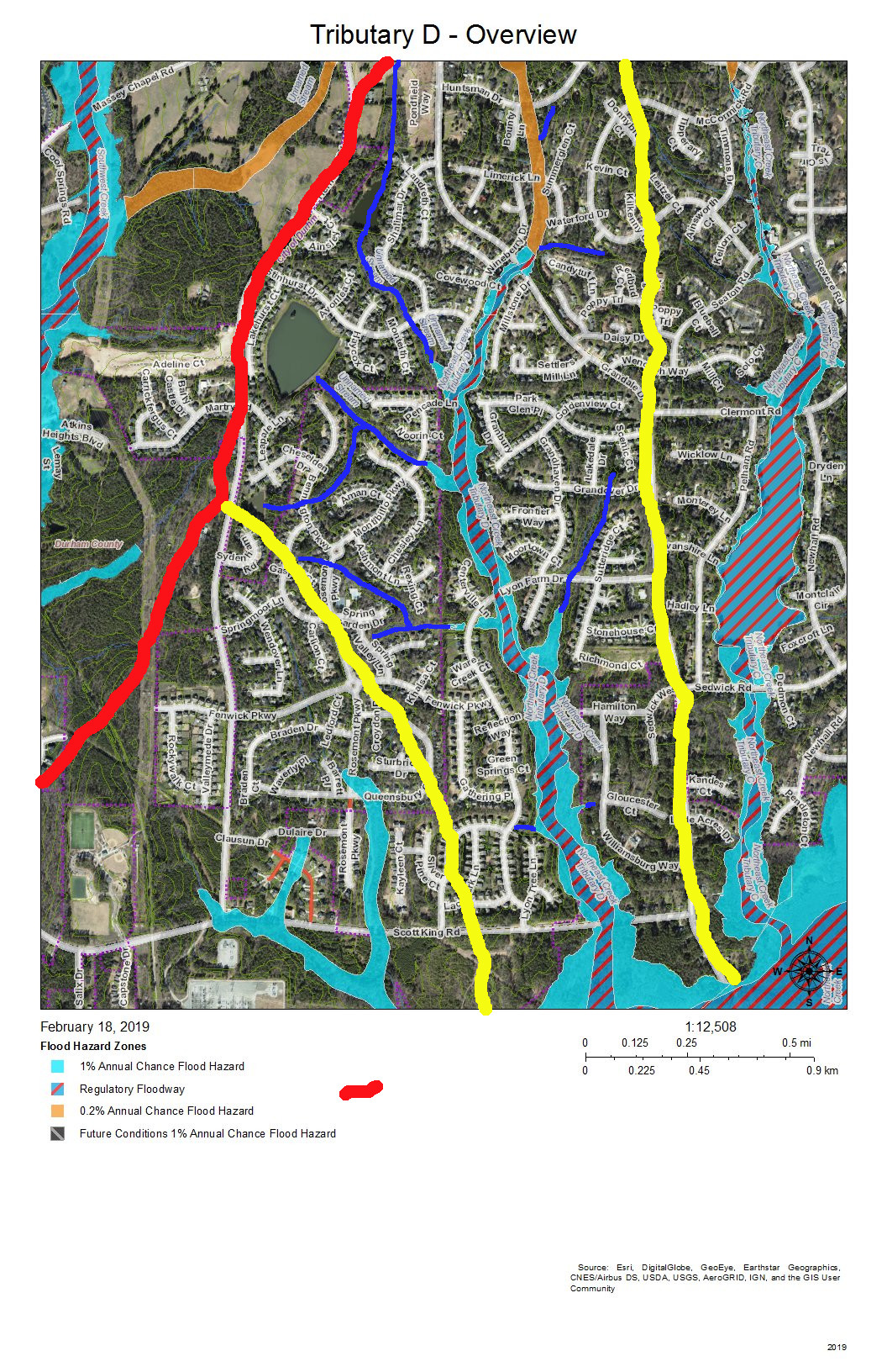
On this map, the red line is the boundary with the Crooked Creek basin. The yellow lines mark the sub-basin of the west fork of Tributary D and the dividing ridge along Grandale that separates Tributary D from Tributary C.
Skim through the maps to the part of Tributary D that you want to examine and then click on the map to enlarge. The sections with streams with blue solid or dotted lines are the section of Tributary D that for which the map is a guide, To enlarge further use the + keys in your viewer or Ctrl-+ on the keyboard. There will be some street references in the text following each map.
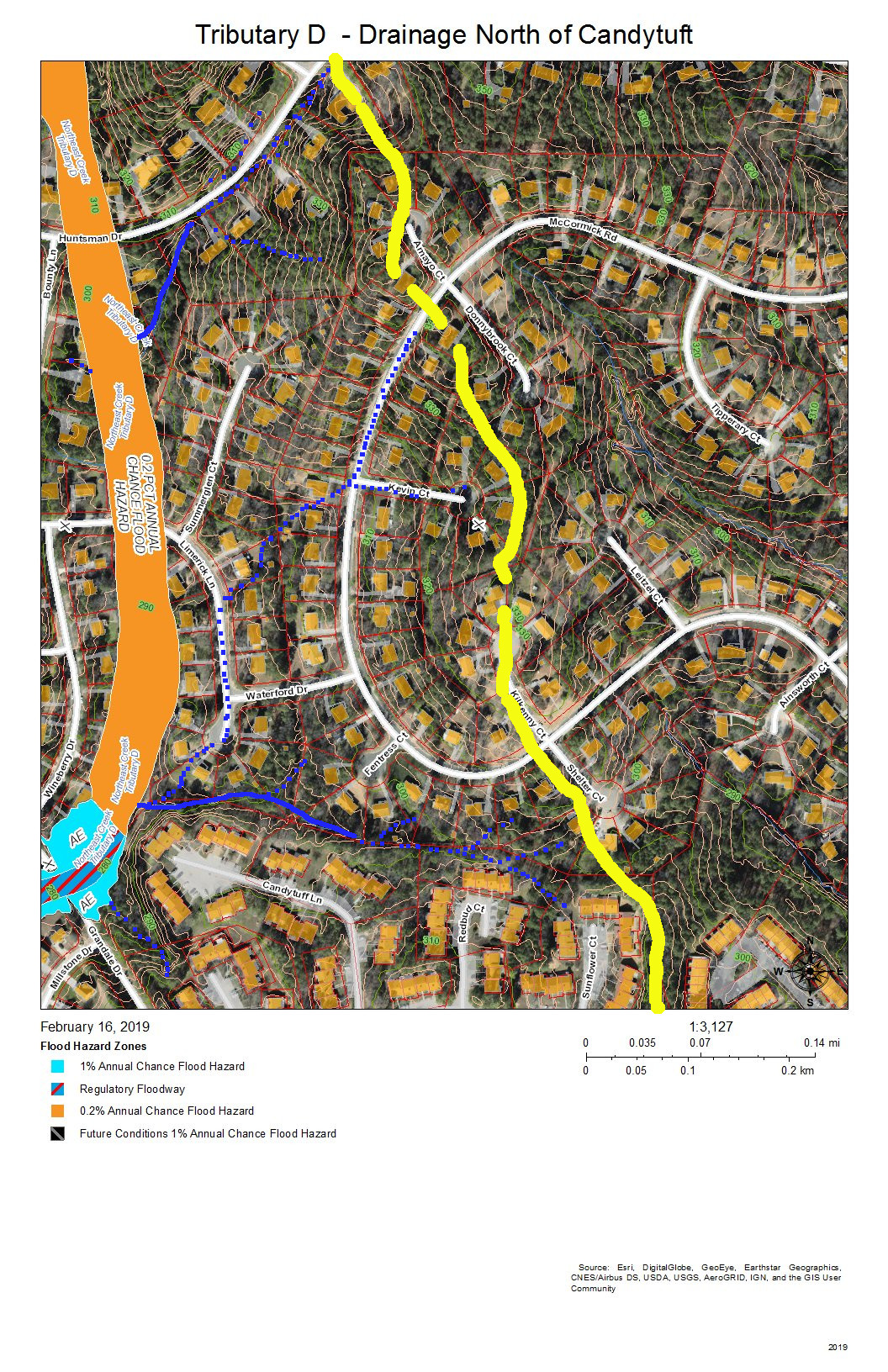
Yellow lines mark the sub-basins of Tributary D. Blue lines are the creeks in the area in the map title. Dotted blue lines are intermittent creeks inferred from the topography or known significant stormwater pipes. The impervious surfaces of roofs are orange within the City of Durham, and the impervious surfaces of parking lots, driveways, and other concrete structures are gray, also within the City of Durham. Outside the City of Durham in Durham County, with the image enlarged enough you can generally understand where roofs, driveways and sidewalks are.
Looking from the mouth of Tributary D and Northeast Creek, the sequence of maps examines each upstream branch and the main stream of Tributary D back to its source near the pond in Hunters Woods.
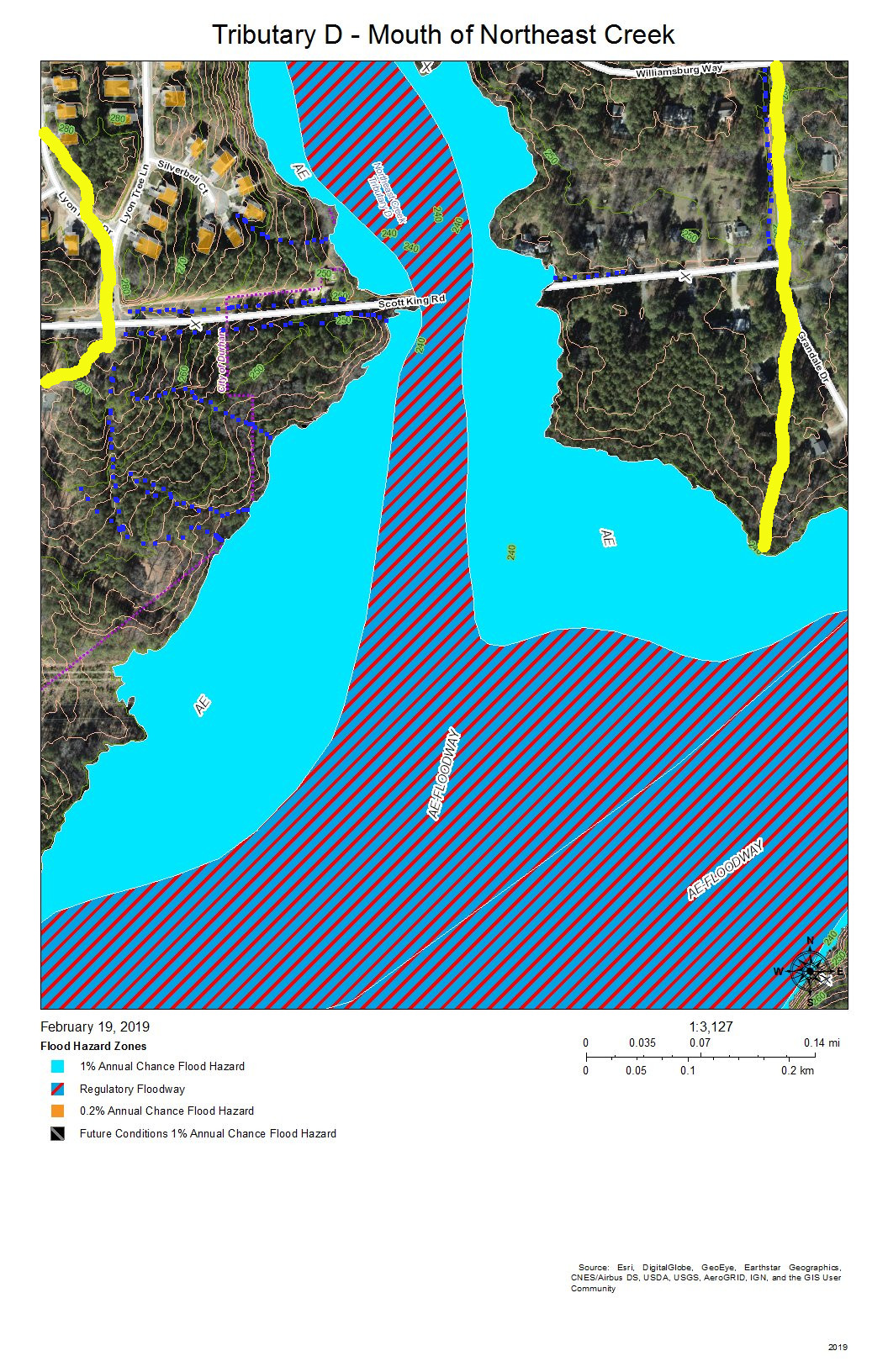
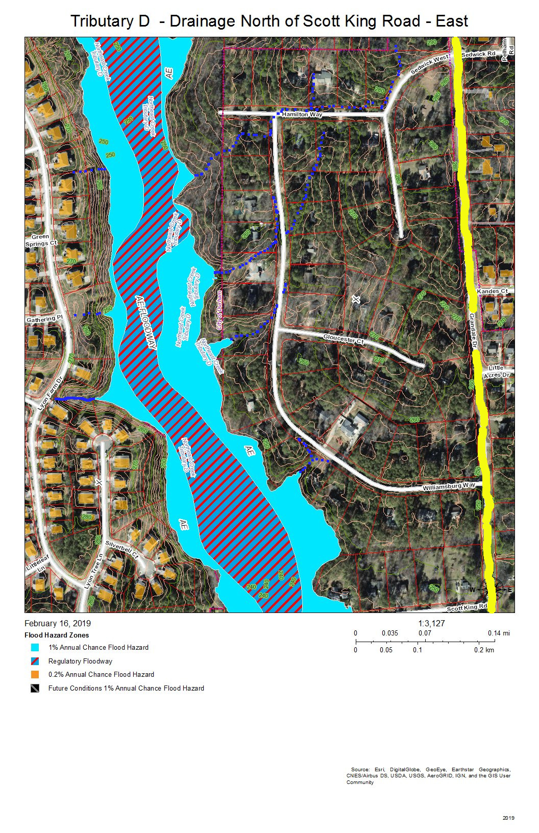
Almost all of the section floodway of Tributary D in this map of the map is in US Army Corps of Engineers land surrounding the headwaters of Lake Jordan. This property does extend north of Scott King Road.
The drainage channels shown on this map are primarily intermittent streams that flow down the swales on either side of Scott King Road and intermittent streams flowing down slopes into Tributary D.
This is an area in which we have cleaned out tires from Corps of Engineers property in past clean-ups.
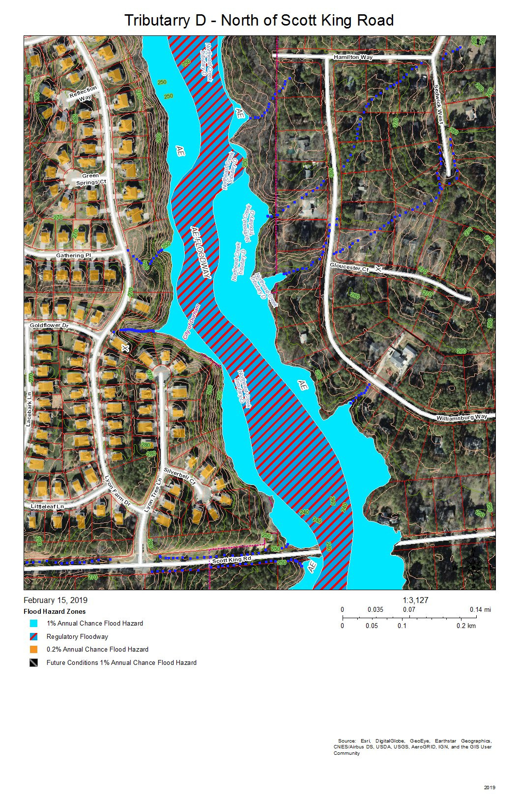
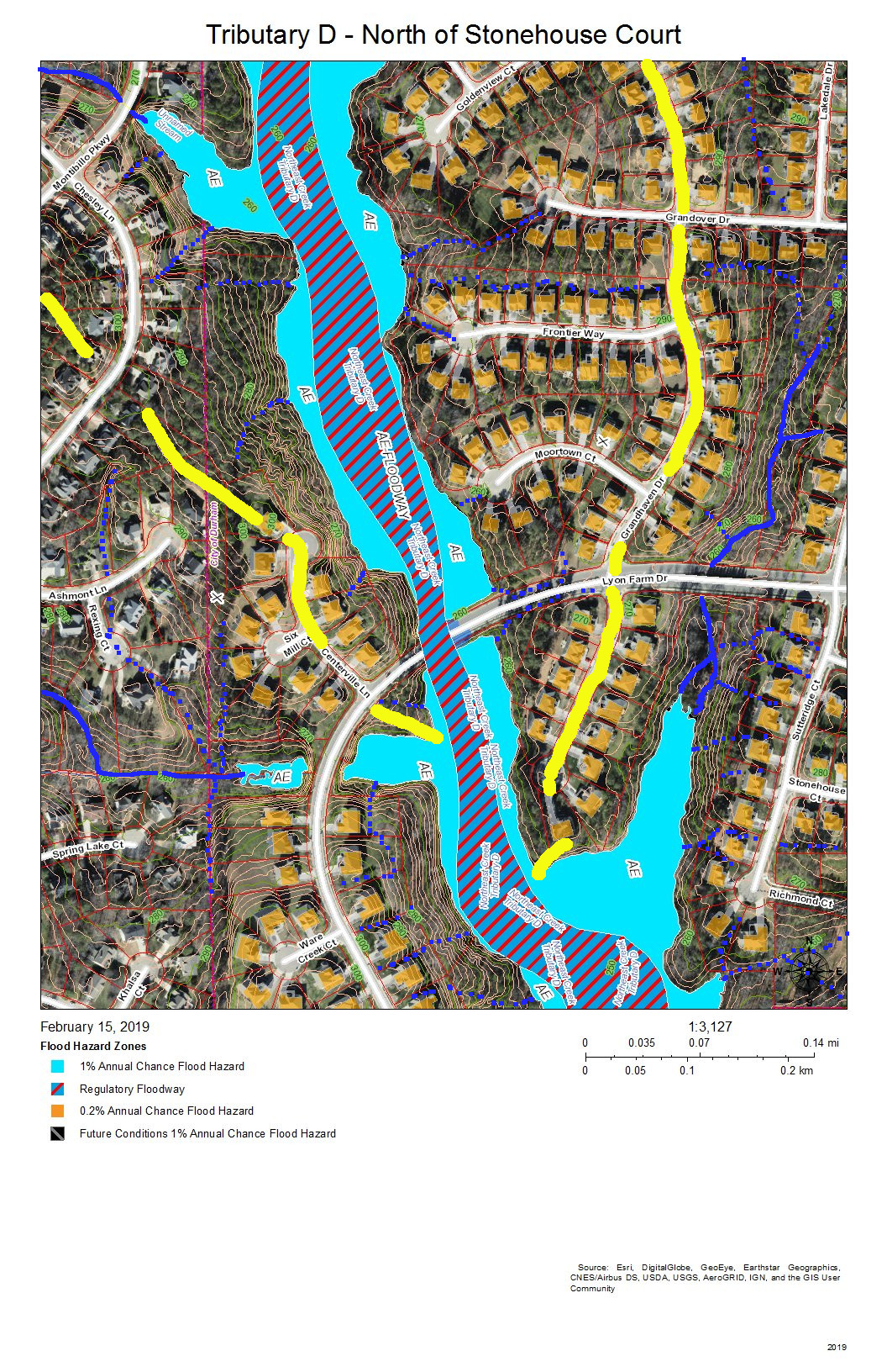
This section of Tributary D is between Lyons Farm on the west and Lake Park on the East. Most of the drainage is from runoff down the slopes, from stormwater pipes not shown on this map, or from the intermittent streams at various points on the stream bank.
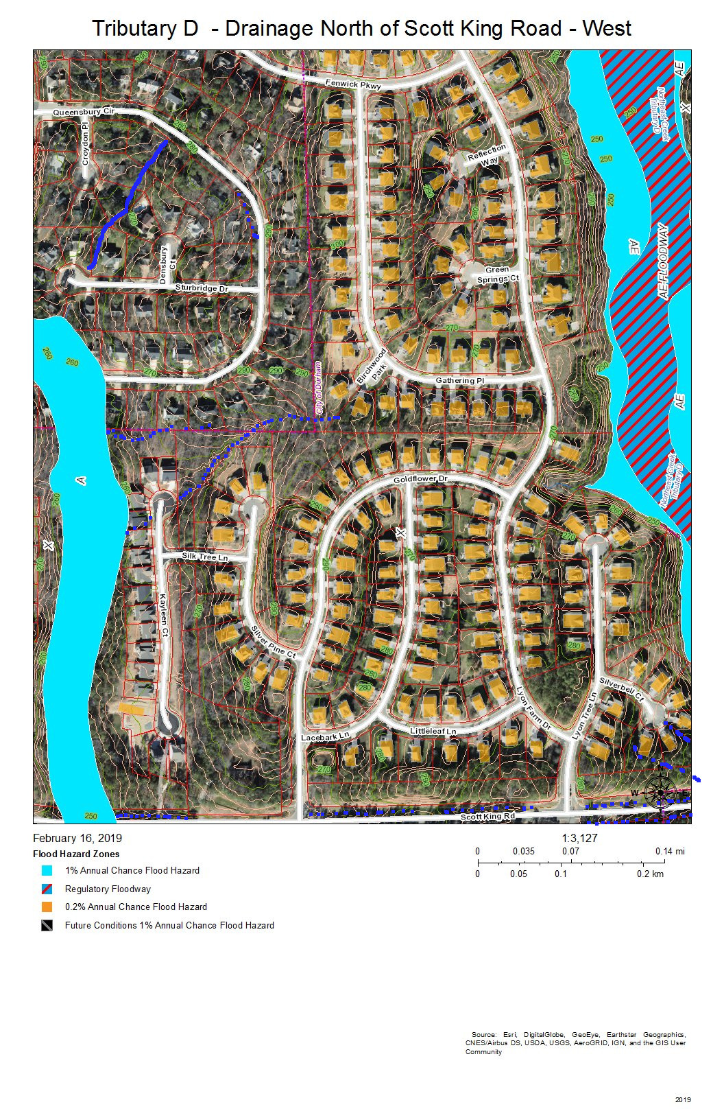
Fairfield, Grandale, and Lyons Farm are the neighborhoods between Tributary D on the east and a fork of Tributary D on the west that crosses Scott King Road just west of Goldflower Drive and joins the Tributary D wetland in Corps land.
Lake Park is the neighborhood on the east bank of Tributary C north of Scott King Road. Drainage is from intermittent streams or stormwater pipes not shown on this map.
Fairfield, Grandale, and Grandale Place are the neighborhoods where the main stream of Tributary D meets some of its own tributaries.
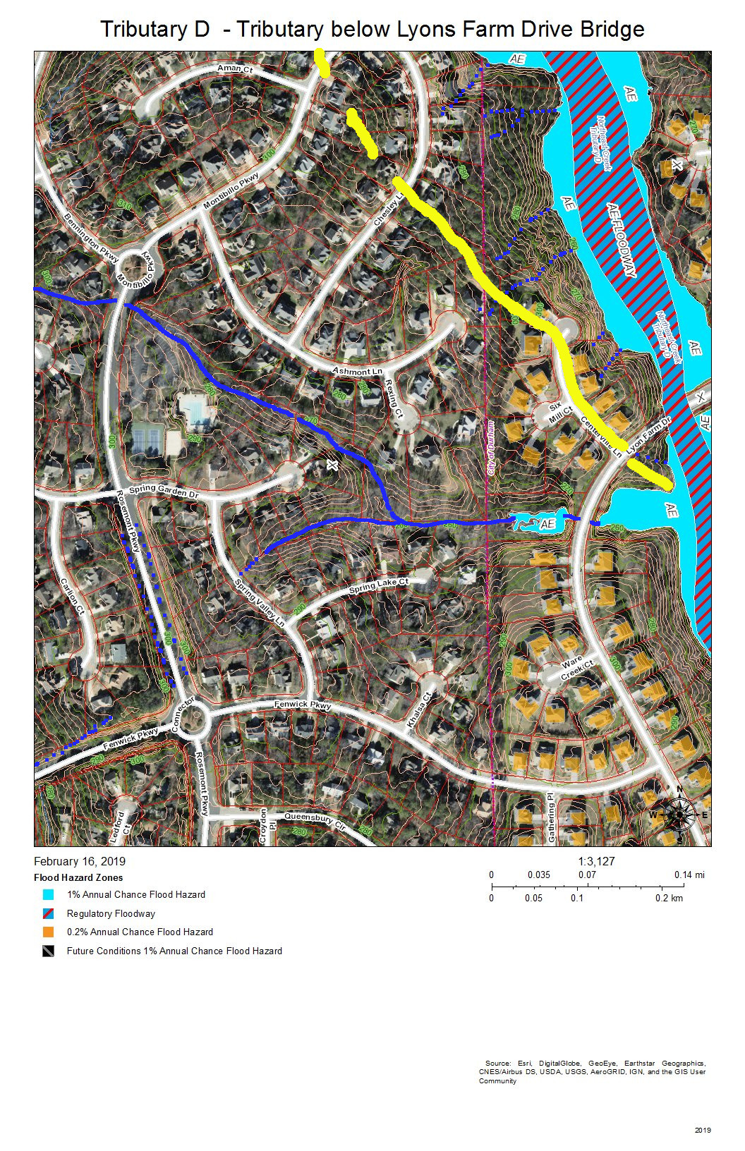
Fairfield and Grandale are the neighborhoods on this section of Tributary D. A tributary stream crosses under Rosemont Parkway just south of the circle on Montibillo Parkway. The yellow line marks the watershed ridge separating the main stream of Tributary D from this tributary.
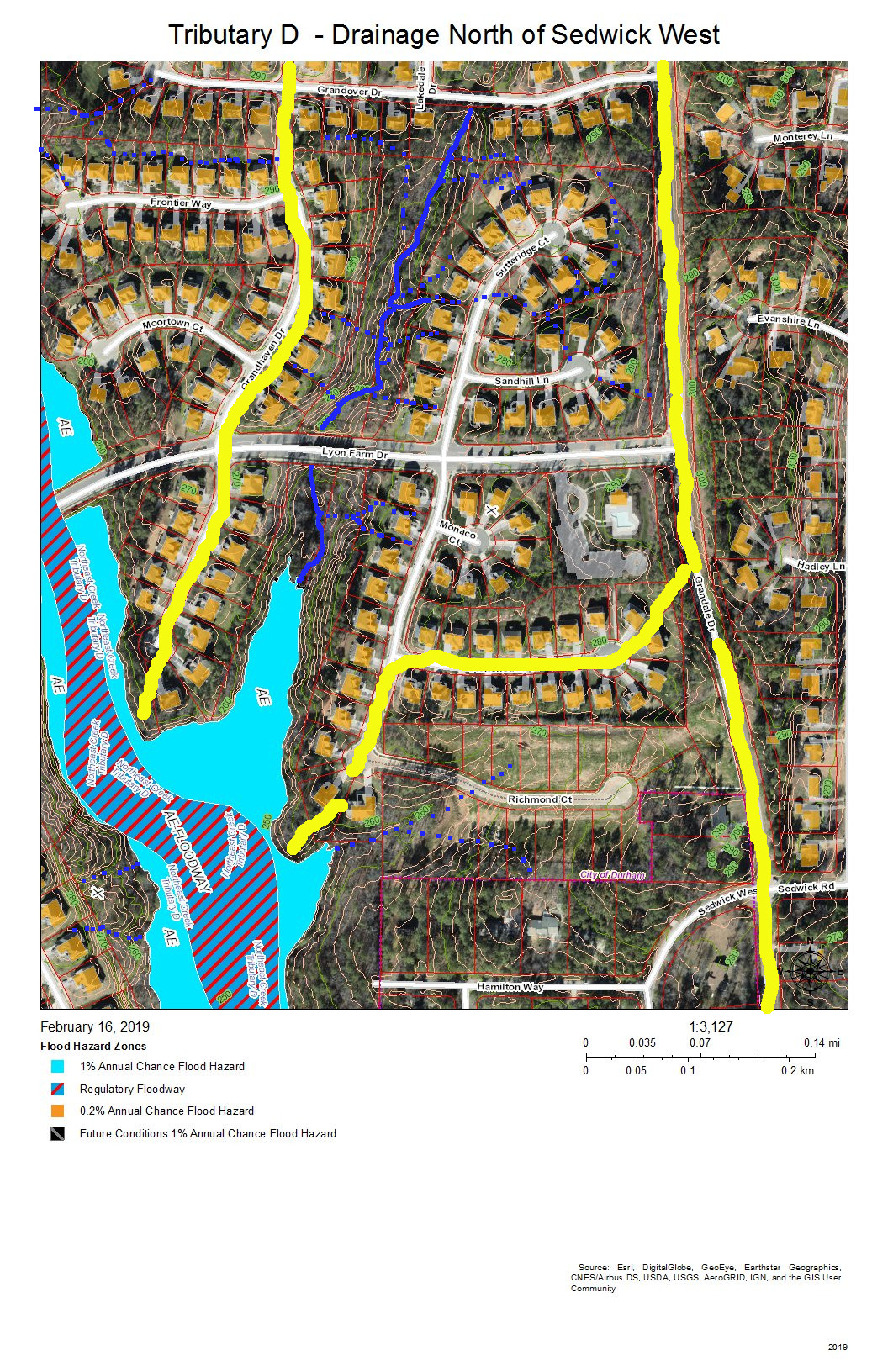
Grandale is the neighborhood in this view, and the neighborhood building at the entrance from Grandale Drive is the one with the L-shaped parking lot. The yellow line along Grandale marks the watershed ridge with Tributary C. The other yellow lines outline the sub-basin of the tributary from Grandover Drive that joins the main stream of Tributary D in this view. Other drainage is from intermittent stream (dotted blue lines) or stormwater pipes not visible on this map.
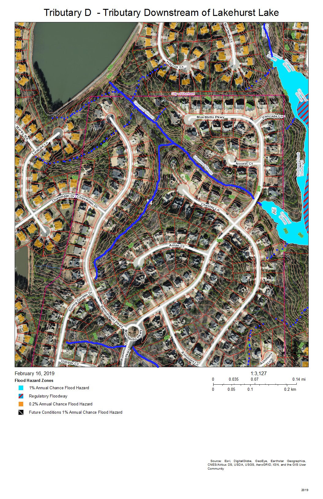
Fairfield and Lakehurst are the neighborhoods in this view. The lake in the Lakehurst neighborhood dams the tributary that flows into Tributary D and that acts somewhat like a retention pond moderating wet and dry weather patterns. Elsewhere, intermittent streams and stormwater pipes not visible on this map drain the runoff from development into the tributary streams.
Grandale Place, Settlers Mill, and the Ridges at Parkwood are the neighborhoods in this view. The drainage flows through stormwater pipes not visible on the map and down intermittent streams (marked with blue dots).
Grandale Place, Settlers Mill, Grandale Forest, and Lakehurst are the neighborhoods in this view. The yellow line at the top is the watershed ridge separating the fork that drains north of Stinhurst Drive from the main stream. The other yellow line shows the sub-basin of the tributary intermittent streams that drain Grandale Place; this might be supplemented with stormwater pipes not shown on this map.
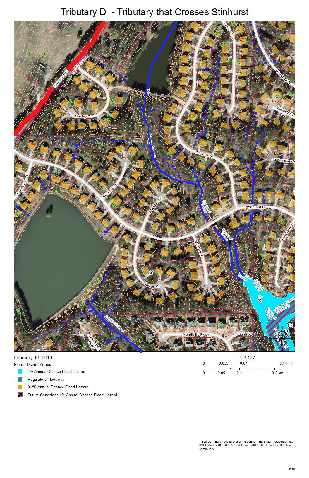
Lakehurst Pointe and Lakehurst are the neighborhoods in this view. The red line shows the watershed ridge between the Northeast Creek basin and the Crooked Creek basin. Two tributaries of Tributary D join the main stream beyond the cul-de-sac at the end of Wineberry Drive. One of these originates above the lake in Lakehurst Pointe; the other originates between the cul-de-sacs of Landreth Court and Middlebury Court in Lakehurst Pointe.
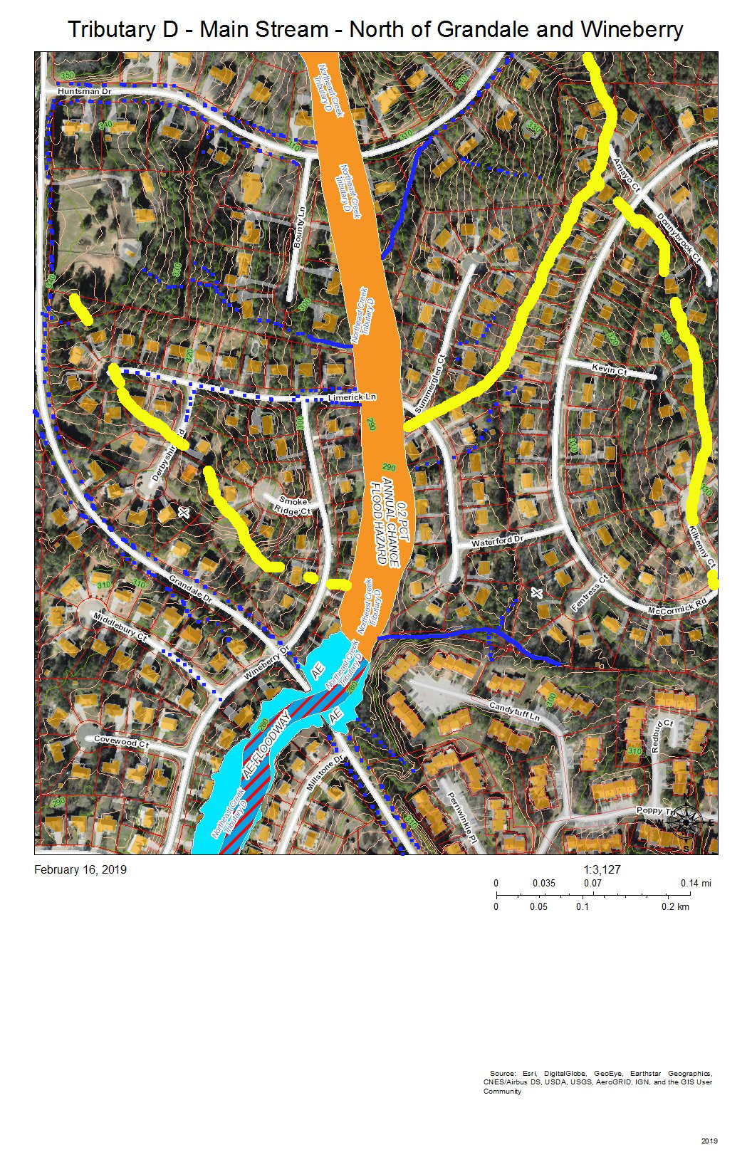
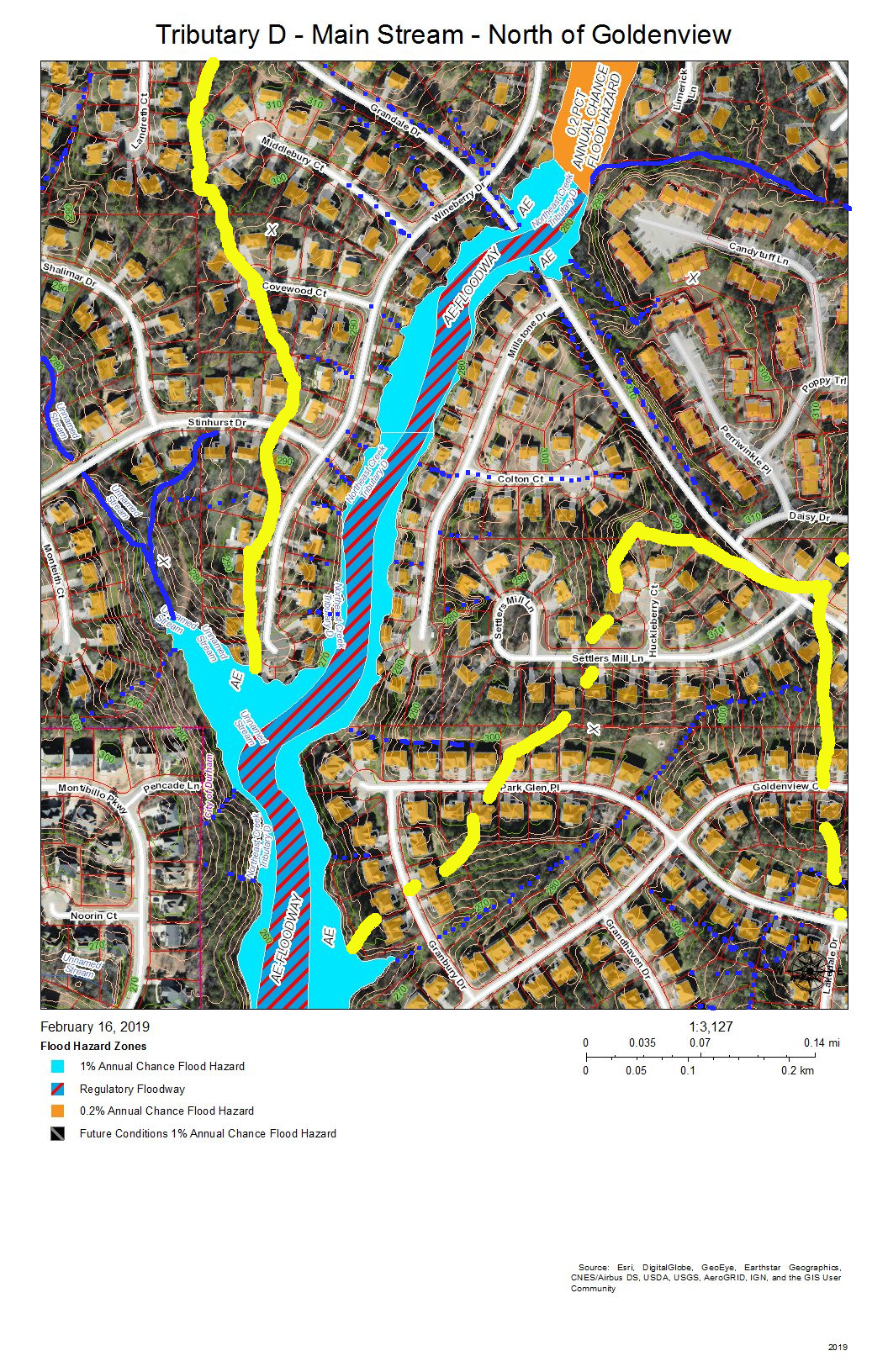
Grandale Forest and Parkwood are the neighborhoods in this view. The intersection of Grandale Drive and Wineberry Drive are the point at which a tributary from the southwestern section of McCormick Road, an intermittent creek from the Ridges, and the intermittent creeks that flow down the swales on either side of Grandale Drive merge before crossing through two 4-foot pipes under Grandale Drive and flowing behind the houses on Wineberry Drive. Over 20 years, the section of creek along Wineberry Drive has scoured almost four feet of depth in the streambed, and water still overflows into yards in heavy rains.
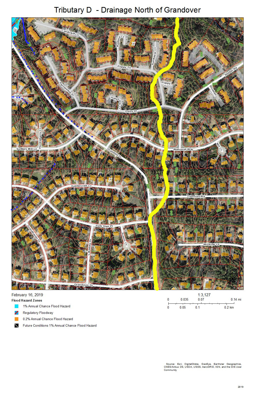
The Ridges of Parkwood, Parkwood, and Hunters Woods are the neighborhoods in this view. The yellow line marks the watershed ridge between Tributary D and Tributary C. Two tributary streams drain this area–one south of Huntsman Drive and one north of Candytuft Lane. An intermittent stream drains the west side of the McCormick highlands and flows down McCormick Road. Another intermittent stream flows down Limerick Lane.
Lakehurst Pointe and Grandin Trace are the neighborhoods in this view. The red line is the boundary between Tributary D and the Crooked Creek basin. The source is in what is soon to be the northwest corner of Grandin Trace and flows into a pond that releases a stream that flows openly and then through stormpipes into the lake in Lakehurst Pointe.
Hunters Woods is the neighborhood in this view. The yellow lines on the east are two sub-basins of tributaries of Tributary C that drain the Meadows at Southpoint. The red line is the watershed ridge between Crooked Creek and Northeast Creek. The yellow line along Barbee Road is the drainage off of Barbee Road that road construction has shifted from the Northeast Creek basin to the Crooked Creek basin. A local high point (elevation over 380 feet) was the site of a NC Forest Service fire tower until shortly before Hunters Wood was developed. This high point allow a ranger to see many square miles of woodlands cultivated on the uplands and bottomlands of Northeast Creek and Crooked Creek.

Parkwood and Hunters Woods are the neighborhoods in this view. The yellow line marks the watershed ridge between Tributary D and Tributary C. The orange in Tributary C is the 0.2 percent chance flood zone in the headwaters of the Meadows at Southpoint retention pond. The orange in Tributary D is the Hunters Woods lake and the overflow path if the dam is topped; this is also a 0.2 percent chance flood zone.
All of the maps in this series are works in progress that need investigation by residents of the neighborhoods reporting what they see on the ground. There are many points that are not clear from aerial views about how the drainage flows. One issue in particular is how the retention pond from Grandin Trace flows into the lake in Lakehurst Pointe. As we get corrections we can edit the maps to apply them and eventually have maps to provide an atlas of the Tributary D basin.
Send corrections to colleen@northeastcreek.org.